This course provides an opportunity for schools with low student numbers to prepare, plan and collect data for their individual Non-Exam Assessment for A Level Geography.
This course price includes in-course transport, whilst at the centre.
Due to safeguarding reasons we are unable to let adult learners attend these courses. To ensure safety all U18s must be accompanied by a responsible adult on residential courses, eg teacher or parent.
The cost of this course is VAT exempt, including in-course transport to field sites. Lunch on the first day is not included, but is on the final day.
Tutor: Field Studies Council Staff
Courses are led by experienced Field Studies Council staff.
Example Timetable
Day 1
Morning
Arrive
Students will be greeted by their tutor, with a welcome talk followed by a brief tour of the centre. Allocation of kit required from the boot store. The teaching will begin by 14.00.
Afternoon
The Carbon Cycle
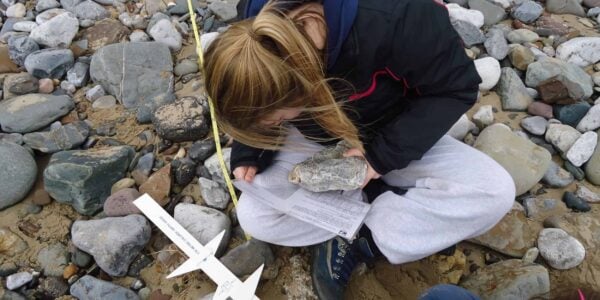
Learners will engage in landscape-scale carbon experiments in the wooded lowlands of the Conwy valley, investigating the impact that land use has on carbon sequestration rates. Through the use of soil experiments, biomass estimation and use of ArcGIS students will estimate carbon content in deciduous woodland. This data will then be analysed using Mann Whitney U, before upscaling the data using ARC GIS online to consider carbon stores on a catchment scale. This work will connect the learners thinking with the role of anthropogenic induced carbon imbalance as a key component of current and future climate change, and carbon sequestration as a form of climate change mitigation. Links will also be made to the hydrological cycle.
Fieldwork site(s): Conwy Valley
Evening
NEA Workshops
Introduction to NEA process and question setting. Quantitative analysis workshop.
Day 2
Morning and Afternoon
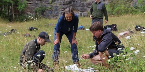
Coastal systems: Landscape, processes and management
Students will investigate possible enquiries at Criccieth on the Llyn Peninsula. Students will spend time completing research on the sample site and
investigate the effectiveness of secondary resources in aiding prior research. Students will interrogate the coastal landscape collaboratively exploring possible inquiry themes and options. The processes operating within this system will be explored through data collection techniques such as beach profiling and sediment analysis. Students will analyse and try methods to evaluate the current coastal defences and management strategies found in Criccieth using techniques such as cost-benefit analysis, bi-polar analysis, Hudson’s equation and flood risk severity mapping.
Finally, the town of Criccieth itself will be explored with students gaining insight into a range of methods to collect data on how the town has been
affected by the implementation of the Shoreline Management Plan.
Field site(s): Criccieth 45 mins
Evening
NEA Workshops
2 Key skills workshops: Data presentation, GIS key skills.
Day 3
Morning
Investigating Place: economic change, regeneration and social inequalities
Visiting the coastal tourist town of Llandudno, learners will use a variety of fieldwork methods to investigate the endogenous and exogenous characteristics that contribute to how this place is viewed by different groups. A true NEA focus will be taken with the day. Students will
consider the appropriateness of methods for investigating different place, regeneration and social inequalities topics as well as the appropriate
sampling strategies to accompany each method. A broad range of questions and investigation themes will be considered, derived from connecting themes and concepts.
Students will collect and use primary and secondary data such as: resident and stakeholder perceptions and questionnaires; variations in housing; environmental quality and crime rates; census information; WIMD scores and super output areas. Learners will follow up this investigation using a mix of qualitative and quantitative data analysis, with the option of a Chi squared statistical test.
Evening
Planning Investigative Geography (The Independent Investigation)
Students will be introduced to the Independent Investigation requirements and will be guided through the route to enquiry and the planning process.
Choosing an area/topic that has been visited in the week, and an interest focus from the student that links to the specification, students will begin planning their Independent Investigation*.
This will include:
- Choosing an area/topic to focus on
- Creating an informed, interesting and viable enquiry question and sub questions
- Finalising a creative methodology, including sampling strategies, sample locations, number of samples, creation of recording tables, sources of secondary data
- Consideration of ethical implications of their investigation
- Consideration of risks involved when undertaking primary data collection - Completing of the NEA proposal form.
*This session is a continuation of the prior planning work that has been completed in school. Students do not need to have a finalised question before coming to the centre however, research into topic, locations and methodologies is strongly advised so that this can be continued into the planning afternoon at the centre.
Day 4
Morning and Afternoon
Field Data Collection for Independent Investigation
Students will visit one of the two study areas from the previous days in order to collect their own primary data. With support from the FSC staff they may adapt and refine their planned methods during the day to ensure validity and reliability.
Fieldwork site(s) will be dependent on students’ projects and staff availability: The Conwy valley (no transport required), Criccieth (45 mins), Llandudno (30 mins)
Evening
An evening outdoor activity
Students have the opportunity to go on a guided nature walk/night walk. There may be the opportunity for mammal trapping and bat detecting. Or alternatively some team games on the front lawn to unwind to celebrate finishing their data collection for their NEA.
Day 5
Morning
Follow up Investigative Geography (The Independent Investigation)
Students will have an opportunity to start writing up the investigation including:
- Methodologies
- Data presentation (including where possible use of ArcGIS)
- Data analysis (including statistics)
Course ends at 12:30.
What's Included
-
 Expert Tuition
 -
 Free Wi-Fi
 -
 Full Board Accommodation
 -
 Hot and Cold Drinks
 -
 In Course Transport
 -
 Picnic Lunch