Have you ever wanted to delve deeper into Earth’s past to uncover how the foundations of our iconic landscapes have shaped today’s environment? Would you like to learn more about geology?
We asked one of our geology experts, David Cronshaw, who undertook his PhD research on the Geology of Eryri (Snowdonia National Park) to give us an insight into its rich geological history.
David has led Geology courses for Field Studies Council for over 30 years and enjoys all aspects of Geology. He is particularly interested in the impact that Geology has on the landscape around us and how rocks have been altered in the millions of years since they were formed.
“A landscape shaped by the contrasting forces of fire and ice.”
In the beginning
The geological story of North Wales begins sometime in the late Pre-Cambrian, say around 600 million years ago. It is hard to be precise with rocks this old as they’ve been through a lot and seen life. At this time North Wales was close to a subduction zone where the ancient ocean was being “consumed” in the vicinity of an ocean trench.
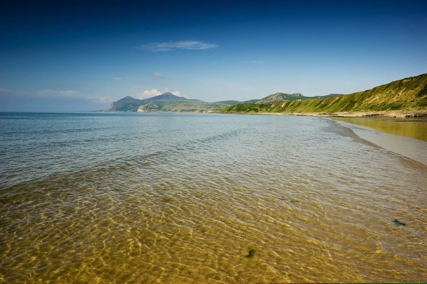
On the Llyn Peninsula, you can see evidence of massive submarine slides linked to the subduction zone and find high-grade metamorphic rocks put under extreme heat and pressure, you can even walk on an ancient sea bed at possibly the most scenic golf course in Britain (Morfa Nefyn).
Towards the very end of the Pre-Cambrian or possibly at the start of the Cambrian, North Wales was rocked by a series of violent volcanic eruptions that produced the nastiest of all volcanic rocks, an ignimbrite. At this time the geography of North Wales is envisaged as being similar to that of modern-day Japan or the Caribbean Islands.

A period of relative calm
During the Cambrian (544 to 510 million years ago), North Wales was just offshore of a super continent called Gondwana! That in itself sounds difficult to believe but it gets better. At this time North Wales was wandering around at about 60 degrees South of the equator. It was somewhere between the modern-day positions of the Southern tip of Chile and the Antarctic Peninsula.
In what were initially very shallow seas, a variety of sediments were laid down from really coarse, pebble-rich conglomerates to fine-grained muds that ultimately produced the world-famous slate belt rocks that “roofed the world” (more on these later) to mixed coarse sands and silts thought to have been deposited on the continental shelf. This period of relative tranquillity was merely the calm before the storm!
A volcanic cataclysm
We then had the Ordovician (510 to 439 million years ago), a period not even recognised by the early geologists!
This period saw North Wales on the move. At the start of the period we were at latitude approximately 55 degrees South, by the end of the period we were only just outside the tropics at 30 degrees South.
The reason for this rapid drift north (approximately 4-5 cms per year on average) was the subduction of the Iapatus Ocean to the North West.
Now you don’t get tectonic movement like this without consequences and the consequence for North Wales was some of the most violent volcanic eruptions in the geological record. These were super super volcanoes! North Wales was in the thick of it with massive eruptions of ash, lava and our old friend the ignimbrite.
These eruptions were so violent that they took the volcano with them, imagine Krakatoa in 1883-almost nothing was left after that went bang. As a result, Eryri (Snowdonia) has a huge array of volcanic rocks but precious few recognisable volcanoes.
The calm after the storm
The drama of the Ordovician was followed by a quieter period, the Silurian (439 to 409 million years ago) although it has to be admitted, it packed a punch towards the end!
Subduction had slowed by this point and the Iapetus Ocean was gradually closing. As a result, there was much less volcanic activity and was not as violent as before.
In North Wales, the Silurian was marked by basin sedimentation with a variety of grits, sandstones, siltstones and mudstones. The further east you go the shallower the basin and along the Welsh border you start to get Silurian limestone. The further South you go, the deposits are more typical of deeper water turbidites produced on a continental shelf.
The big bang
Then the inevitable happened!
Towards the end of the Silurian, North Wales was in the tropics at latitude 20 degrees South. After the best part of 100 million years of subduction the Iapetus Ocean was finally consumed and the continents of Laurentia and Baltica/Avalonia collided.
Imagine modern India colliding with the rest of Asia, where the two meet is chaos, the result of which is the awe inspiring Himalayas.
Over 400 million years ago in a similar dramatic event the Caledonian mountains of North Wales, the Lake District, much of Scotland and Scandinavia and even the Appalachians were formed the remains of which we see today
That is one of the reasons why we have such spectacular scenery in Eryri, that and the variety of volcanic rocks produced in the Ordovician.
Not only were mountains like the modern Alps formed, but the rocks were squeezed and heated. What had once been lowly mudstones were transformed into the slate that Wales is rightly famous for.
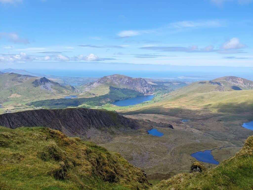
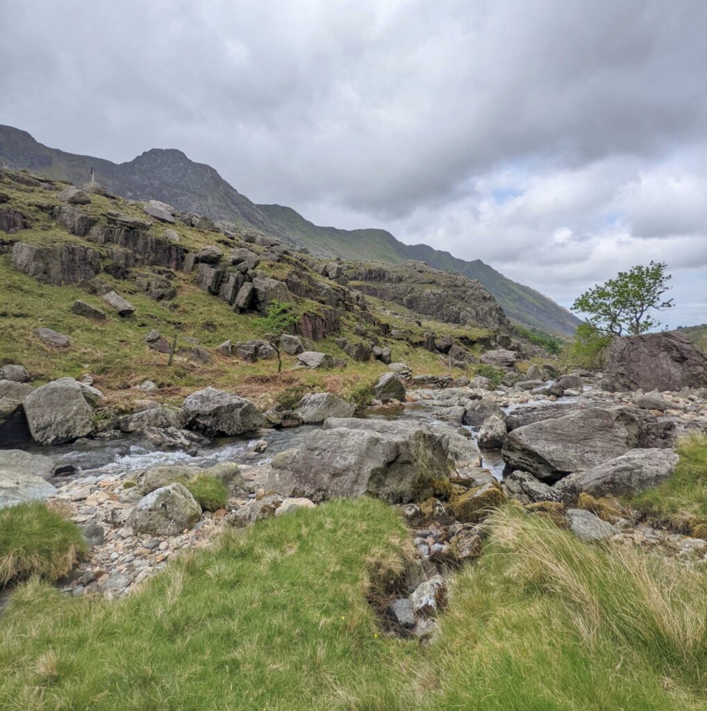
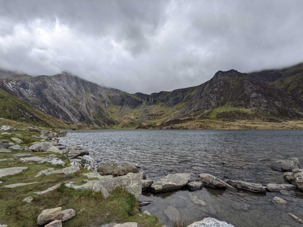
In addition, numerous quartz veins were produced which lie dotted around the landscape to this day. The rocks that were laid down in broadly horizontal units were contorted into spectacular folds in places like Cwm Idwal and Snowdon (Yr Wyddfa) itself. After this North Wales was high and dry for 40 million years, a time when erosion of the newly formed mountains dominated.
An equatorial Wales
At the start of the Carboniferous, about 363 million years ago, sea levels rose and limestone, sandstone and eventually coal was deposited.
The seas never covered what is now Eryri as the Caladonian mountains stood proud as they do today.
Limestone can be found along the coast and towards the English border where coal was also deposited.
Since the Carboniferous, North Wales has remained above sea level so there are no rocks younger than this until you reach the Marcher counties of England, a gap of the best part of 290 million years. All was not done though. Wales continued to drift steadily North to its current latitude, the Caledonian mountains continued to be whittled away and last, but not least, the weather took a turn for the worse!
Wales, a chilly outlook
The last major geological event to impact Wales and, arguably, the most significant in terms of the modern-day scenery was the ice age or, more accurately, a series of glacial events stretching over 2 million years.
In central Eryri, the trauma of glaciation is etched on every facet of the landscape. Further out towards the coast and along the Llyn Peninsula there are massive deposits of material scoured out and transported by the glaciers until they lost energy and dropped what they were carrying. Without glaciation, the scenery of North Wales wouldn’t be as dramatic as it is today.
Want to learn more and see this geological history brought to life?
David is hosting a unique course at our centre near Betws-y-Coed, the Gateway to Eryri (Snowdonia) between 18th – 22nd August 2025 next year.
Geology and Scenery of Snowdonia (Eryri)
You’ll get the opportunity to view evidence of this incredible story and examine it in the context of some of the most beautiful and dramatic landscapes of the UK.
By the end of the course the unbelievable will become just that little bit more believable.