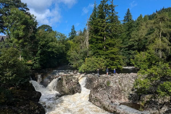
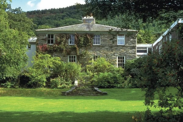
The area surrounding Rhyd‑y‑Creuau provides access to a wide range of contrasting environments, including upland landscapes, river catchments, woodland, moorland, glacial landforms and nearby coastal systems. Rhyd‑y‑Creuau Field Centre is located in the Conwy Valley, at the gateway to Eryri (Snowdonia) National Park, set within wooded grounds with access to a variety of fieldwork locations.
Rhyd‑y‑Creuau Field Centre provides immediate access to a highly distinctive landscape shaped by glaciation, river processes and land use. The surrounding environment includes open moorland, steep valleys, gentle‑flowing rivers and managed woodland, with additional contrasting locations accessible nearby. This setting is particularly well suited to investigations into upland processes, river systems, landscape change, land‑use impacts and management, while also supporting enquiry skills, data collection and independent investigation.
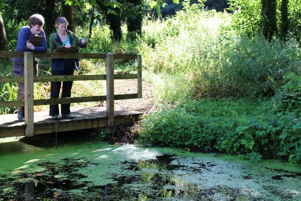
These fieldwork sites support studies in geography, biology and environmental science, enabling students to investigate physical processes, environmental systems and human–environment interactions through first‑hand data collection. The close proximity of upland, river and woodland environments allows students to explore how landscapes interact and change across short distances.
Explore the field sites used at Rhyd‑y‑Creuau
An example of our sites are set out below. When transport is required for offsite fieldwork, additional in-course costs are incurred and clearly stated in your programme
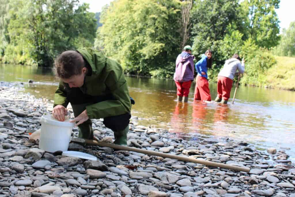
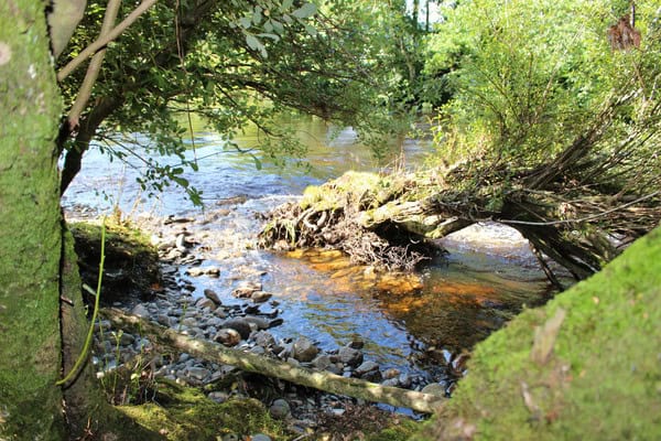
Afon Conwy and catchment
The Afon Conwy runs close to the centre and forms a core freshwater field site. Students investigate river processes, channel characteristics and catchment influences, alongside human interactions such as flood risk and management within the Conwy Valley.
Conwy Valley and Llanrwst
The wider Conwy Valley provides a contrasting lowland setting shaped by both physical processes and human activity. Llanrwst is used as a case‑study location for investigating flood risk, land use, hydrological management and community resilience using field data and GIS.
The quality of the delivery was amazing. Everything was planned and organised with precision. The focus on key concepts meant these were reinforced continuously. I have never seen students so clear on accuracy reliability and different types of sampling techniques. The teaching in the field was outstanding. Students had a really good understanding of what they were doing and why, and did it effectively.
- Teacher, Queen Annes School 2025
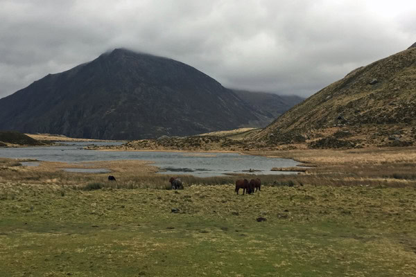
Migneint Moors
The upland peat landscapes of the Migneint Moors provide an extensive moorland environment used for large‑scale investigations into carbon storage, sequestration and landscape‑scale environmental processes. These sites allow students to explore soil carbon, biomass and land‑use impacts in an upland setting.
Coed Hafod Ancient Woodland
Coed Hafod is an ancient oak woodland within walking distance of the centre. It is used for terrestrial fieldwork, including investigations into woodland structure, biodiversity patterns, environmental gradients and comparative ecosystem studies.
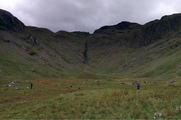
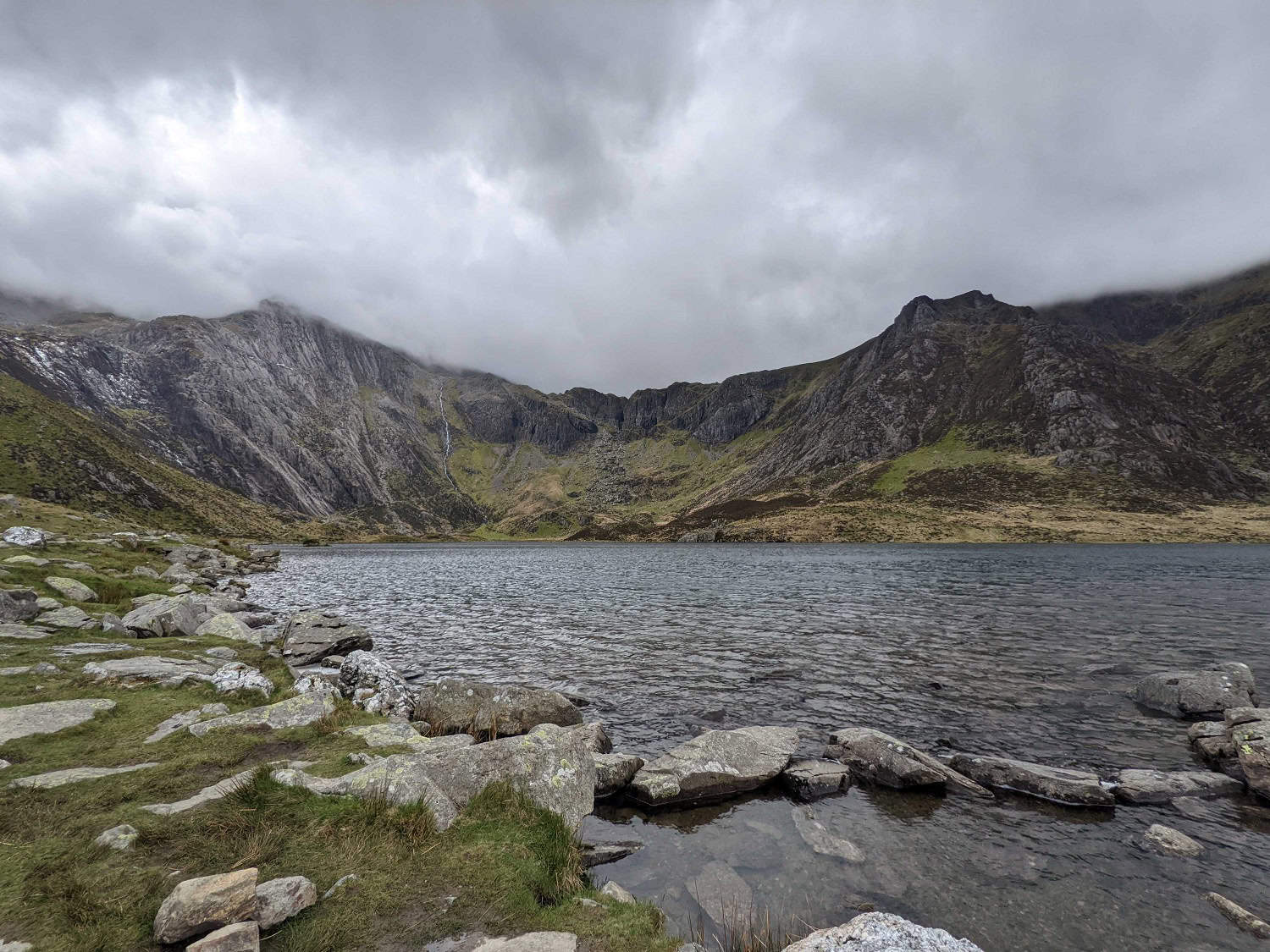
Cwm Idwal National Nature Reserve
Cwm Idwal is a classic upland glacial landscape within Eryri National Park. Students explore erosional and depositional landforms including corries, moraines, roche moutonnées and U‑shaped valleys, making it an outstanding site for studying glacial systems and landscape evolution.
Nant Ffrancon Valley (Pentir and Aberogwen)
This lowland glacial landscape provides clear evidence of depositional features such as eskers, kames, tills and varves. Fieldwork here focuses on reconstructing past glacial environments and understanding sediment transport and deposition.
“We packed lots into 4 days and this really worked for our students. Days in Llandudno and criccieth to explore data collection were well led by Ian, the classroom sessions on these days were also purposeful and the resources were great. The day of data collection was well organised. The final day for classroom based study was also useful to get students on track with work before returning to school.”
– Teacher, Maltby Academy 2025
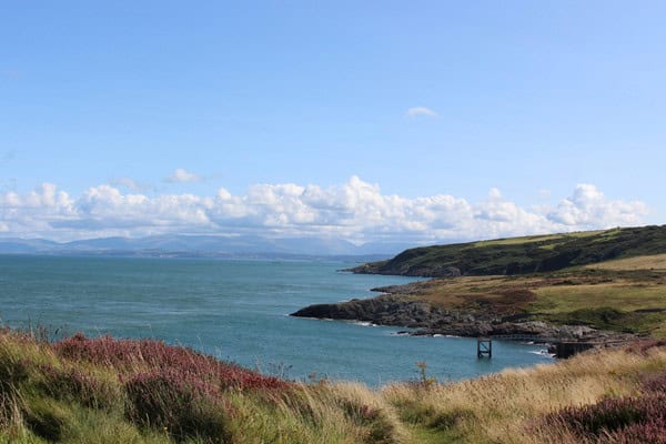
Criccieth Coast
The coastline at Criccieth provides access to a dynamic coastal system influenced by physical processes and human management. Students investigate beach profiles, sediment characteristics, coastal defences and the impacts of shoreline management on the coastal town.
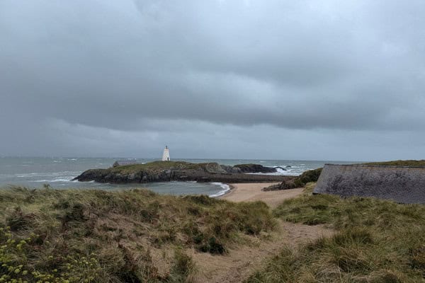
Penmon Point, Anglesey
Penmon Point is used primarily for rocky shore fieldwork. Students investigate zonation, exposure gradients and coastal processes across the intertidal zone, supporting both geographical and biological lines of enquiry.
“Emily was such a knowledgable, helpful, interactive and engaging tutor! Not only on the theory side of the spec, but also how to apply that knowledge in the field. Little nuggets of information such as bird species, plant species etc made the activities much more than just a tick box specification exercise. The course has also been extremely useful for our learners who crossover into Geography and Geology! Would thoroughly recommend this course and I would not hesitate to return back in the future.”
– Teacher, Halesowen College 2025
How fieldwork is conducted at Rhyd-y-Creuau
Fieldwork at Rhyd-y-Creuau is structured around a clear route of enquiry, combining classroom learning with practical investigation in the field. Session begin with a classroom introduction where students are introduced to key concepts, terminology and fieldwork techniques. Students develop an understanding of the aims of the investigation, consider appropriate sampling methods and review risk assessments, ensuring they are prepared before entering the field.
Students then undertake fieldwork at carefully selected sites, where they apply techniques, collect primary data and make observations in real environments. This supports the development of practical skills such as measurement, sampling, identification and accurate recording.
Follow‑up sessions take place back at the centre, later in the day, enabling students to process, analyse and interpret their data. Back in the classroom, students present findings, identify patterns and apply appropriate statistical or graphical techniques. These sessions also provide opportunities to evaluate methods, consider limitations and link outcomes to theory, supporting deeper understanding.
Across a course, students progress from guided activities towards more independent enquiry. This approach builds confidence in planning, carrying out and communicating fieldwork, while developing the knowledge and skills required for geography, biology and environmental science.