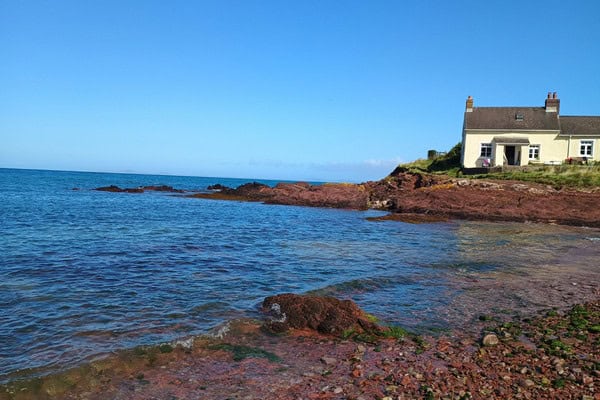
The surrounding area provides access to a wide range of contrasting coastal, freshwater and rural environments including sandy beaches, rocky shores, cliffs, sand dunes, saltmarsh, estuaries, rivers and rural settlements. Dale Fort Field Centre is located on the Pembrokeshire coast in west Wales, overlooking St Brides Bay and within Pembrokeshire Coast National Park.
Dale Fort Field Centre provides immediate access to a dynamic coastal landscape, with rocky shores and coastal paths accessible directly from the centre. Nearby beaches, dune systems, saltmarshes, river catchments and settlements can be reached quickly by minibus, allowing students to carry out high‑quality fieldwork across a variety of physical and human environments within a compact area.

These fieldwork sites support studies in geography, biology and environmental science, enabling students to investigate physical processes, ecological systems and human–environment interactions through first‑hand data collection. The proximity of exposed Atlantic coastlines, sheltered bays and inland catchments allows students to explore environmental systems, spatial variation and change over time at multiple scales.
Explore the field sites used at Dale Fort Field Centre
An example of our sites are set out below. *When transport is required for offsite fieldwork, additional in-course costs are incurred and clearly stated in your programme.
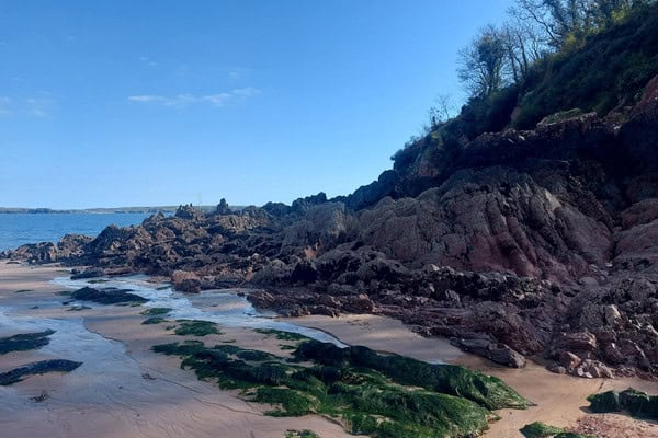
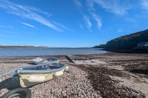
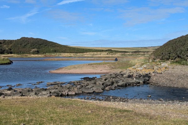
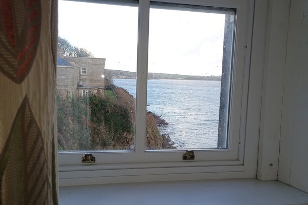
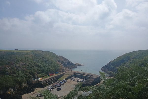
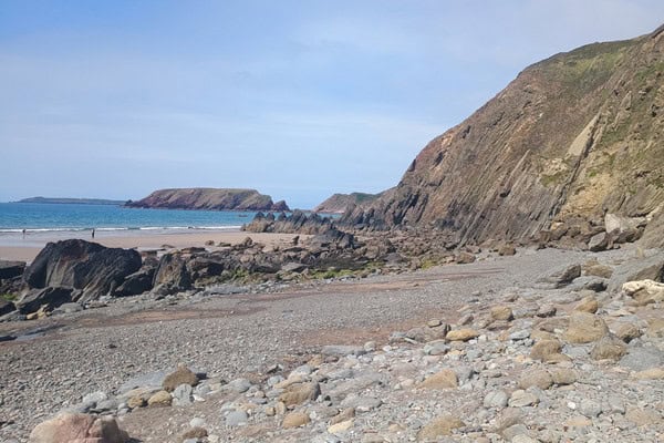
Dale Fort Estate and immediate coastline
The coastline surrounding the centre provides direct access to rocky shore and coastal fieldwork locations within walking distance. These sites are used extensively for rocky shore ecology, coastal process investigations, sampling skills, ecological energetics and behaviour studies.
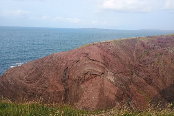
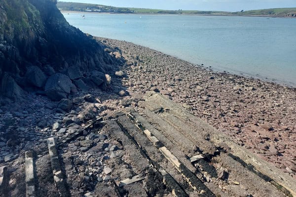
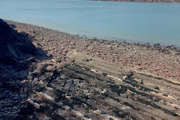
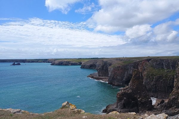
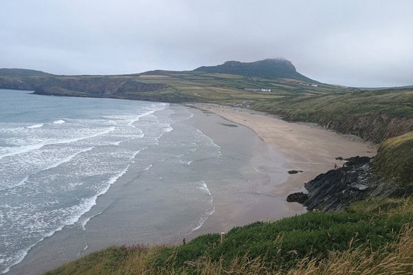
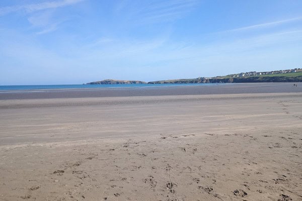
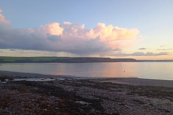
St Brides Bay
St Brides Bay provides a large‑scale coastal fieldwork setting, accessed by short minibus journeys from the centre. It is used for beach profiling, sediment analysis, coastal flooding, erosion risk, NEA data collection and evaluation of coastal management strategies.
Broad Haven and Newgale
Broad Haven and Newgale are used for coastal process and coastal defence fieldwork. These sites support investigations into beach profiles, sediment characteristics, erosion and deposition, and contrasting approaches to coastal management.
“The students gained a great deal from the experience and enjoyed the opportunity to learn in such a beautiful environment. Your team were welcoming and clearly committed to supporting fieldwork-based learning. We’re already looking forward to returning next year.”
– Teacher, SPGS 2025
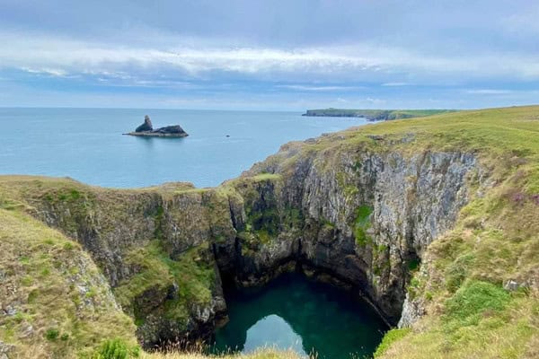
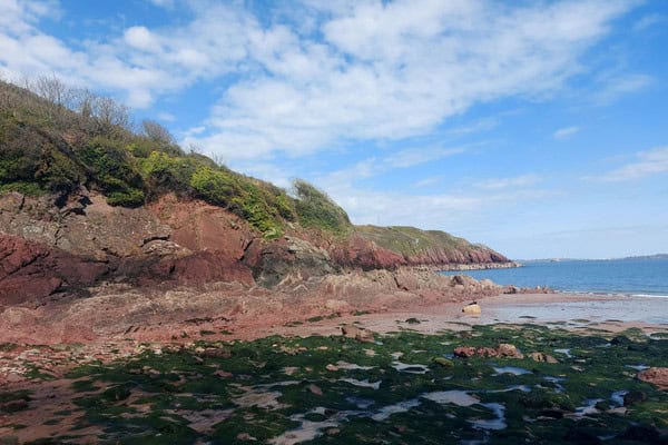
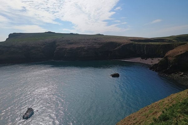
Barafundle Bay and Middle Cove
Barafundle Bay and Middle Cove are used as contrasting coastal locations for A‑level fieldwork. Students investigate differences in coastal processes, sediment size and landform development across multiple sites.
Freshwater West and Broomhill Burrows
Coastal dune systems at Freshwater West and Broomhill Burrows are used for ecosystem and succession studies. These sites support investigations into dune formation, zonation, primary succession and the impact of human activity on sensitive environments.

The Gann saltmarsh
The Gann saltmarsh provides access to a well‑developed saltmarsh system used for succession, sedimentation and ecosystem process studies. Fieldwork focuses on halosere succession and habitat management.
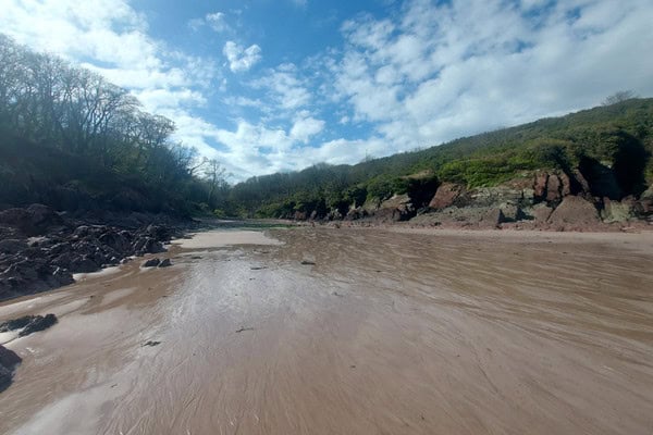
Afon Syfynwy and local river catchments
Local river systems including the Afon Syfynwy are used for river process studies, drainage basin investigations and flood risk analysis. These sites support quantitative measurements of velocity, channel characteristics, downstream change and human impact on river systems.
Local freshwater sites near the centre
Freshwater environments close to the centre are used for water quality, freshwater pollution, soil analysis, population monitoring and ecological energetics investigations across Biology and Environmental Science courses.
“The education team were fantastic. They were very knowledgable and were able to suggest changes to itinery for future courses. They circulated well in the classroom and outdoors to check that students understood what to do.”
– Teacher, Cardiff Sixth Form College 2025
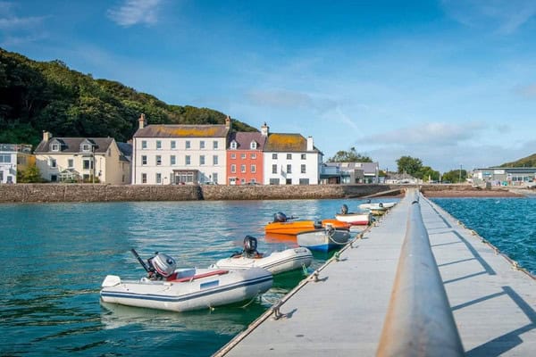
Milford Haven and Haverfordwest
Milford Haven and Haverfordwest provide contrasting urban field sites accessed by centre transport. These locations are used for studies of changing places, regeneration, rebranding, quality of life, sustainability and economic change.
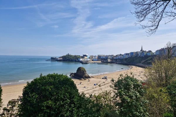
Tenby and surrounding coastal settlements
Tenby and nearby coastal settlements are used for tourism studies, place perception, quality of life investigations and A‑level independent investigation data collection. These sites support a wide range of qualitative and quantitative enquiry methods.
Local rural villages
A range of rural villages near Dale Fort are used for comparative rural geography studies. These locations support investigations into rural change, deprivation, service provision and settlement characteristics.
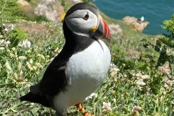
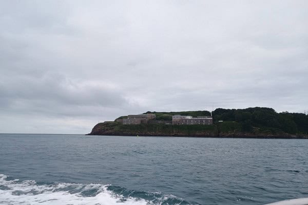
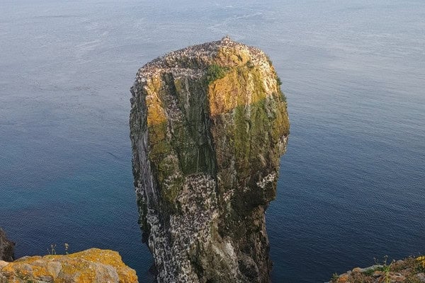
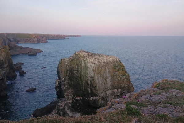
Skomer Island (optional field site)
Skomer Island is used as an optional field site for Biology and Environmental Science courses. Visits support studies of biodiversity, population ecology and conservation management within a marine environment.
Dale Fort Field Centre is widely used by schools and colleges for GCSE and A‑level fieldwork and independent investigations. The combination of nationally important coastal habitats, diverse ecosystems and nearby rural and urban settlements makes Dale Fort particularly well suited to curriculum‑linked fieldwork in a distinctive coastal setting.
How fieldwork is conducted at Dale Fort
Fieldwork at Dale Fort is structured around a clear route of enquiry, combining classroom learning with practical investigation in the field. Session begin with a classroom introduction where students are introduced to key concepts, terminology and fieldwork techniques. Students develop an understanding of the aims of the investigation, consider appropriate sampling methods and review risk assessments, ensuring they are prepared before entering the field.
Students then undertake fieldwork at carefully selected sites, where they apply techniques, collect primary data and make observations in real environments. This supports the development of practical skills such as measurement, sampling, identification and accurate recording.
Follow‑up sessions take place back at the centre, later in the day, enabling students to process, analyse and interpret their data. Back in the classroom, students present findings, identify patterns and apply appropriate statistical or graphical techniques. These sessions also provide opportunities to evaluate methods, consider limitations and link outcomes to theory, supporting deeper understanding.
Across a course, students progress from guided activities towards more independent enquiry. This approach builds confidence in planning, carrying out and communicating fieldwork, while developing the knowledge and skills required for geography, biology and environmental science.
Would you like to find out more?
"*" indicates required fields