- This is a packed five day course for OCR A level Geology students providing the opportunity to complete the four days of fieldwork required and for students to ‘Think Geologically’ about unfamiliar locations.
- Throughout the course students will cover content from the seven modules at A level and develop their practical skills through fieldwork that will be assessed in the written examination, enabling students to apply knowledge and concepts to understand field observations.
- Students will also have the opportunity to complete some of the Practical Activity Groups (PAGs) during fieldwork. Demonstrating competency in the skills identified and the use of specific apparatus and techniques.
- This course will develop students’ mathematical and quantitative skills in geology, including the application of inferential statistical tests to geological field data.
- ICT will be used throughout including data collection using tablets in the field and using Geographical Information Systems to plot geological field data.
Example Timetable
Day 1
Morning
Arrive Midday
- Students greeted by FIeld Studies Council staff.
- Welcome talk and Centre tour.
- Pre-course meeting with staff and teachers.
- Allocation of wellies/waterproofs.
Afternoon
Introduction to the Geology of the Local Area
During this first interactive session, students will have the opportunity to immerse themselves in a stunning geological location close to the field centre. Using a range of secondary sources and first hand observations students will build up their knowledge of the geological history of the area.
PAG 1 Investigating minerals and rocks
Use keys, photomicrographs and investigation of hand specimens to identify rock types.
Evening
Students will familiarise themselves with the concepts and models appropriate to the course. Engagement with the skills, techniques and apparatus appropriate to the geological fieldwork enquiry process.
Objectives will be set for the course which:
- Link to the OCR Geology specification. (Modules 2-7)
- Consider practical skills needed for geological fieldwork.
Students will consider how to conduct their fieldwork responsibly, showing awareness for their own safety and impact on the environment. If time/day light allows some of this session can be delivered outdoors including:
- Making and recording observations/measurements.
- Keeping appropriate records of experimental activities.
- Presenting information and data in a scientific way.
Day 2
Morning and Afternoon
PAG 6 Investigating Geological Sequences
Field based investigation of an outcrop to determine geochronology and process of deposition and/or rock emplacement.
Skills, apparatus and techniques covered:
- Students will locate the geological feature in the local area
- Through field observations, sketches and photographs (including the use of fiducial scale) students will identify geological structures present in the outcrop
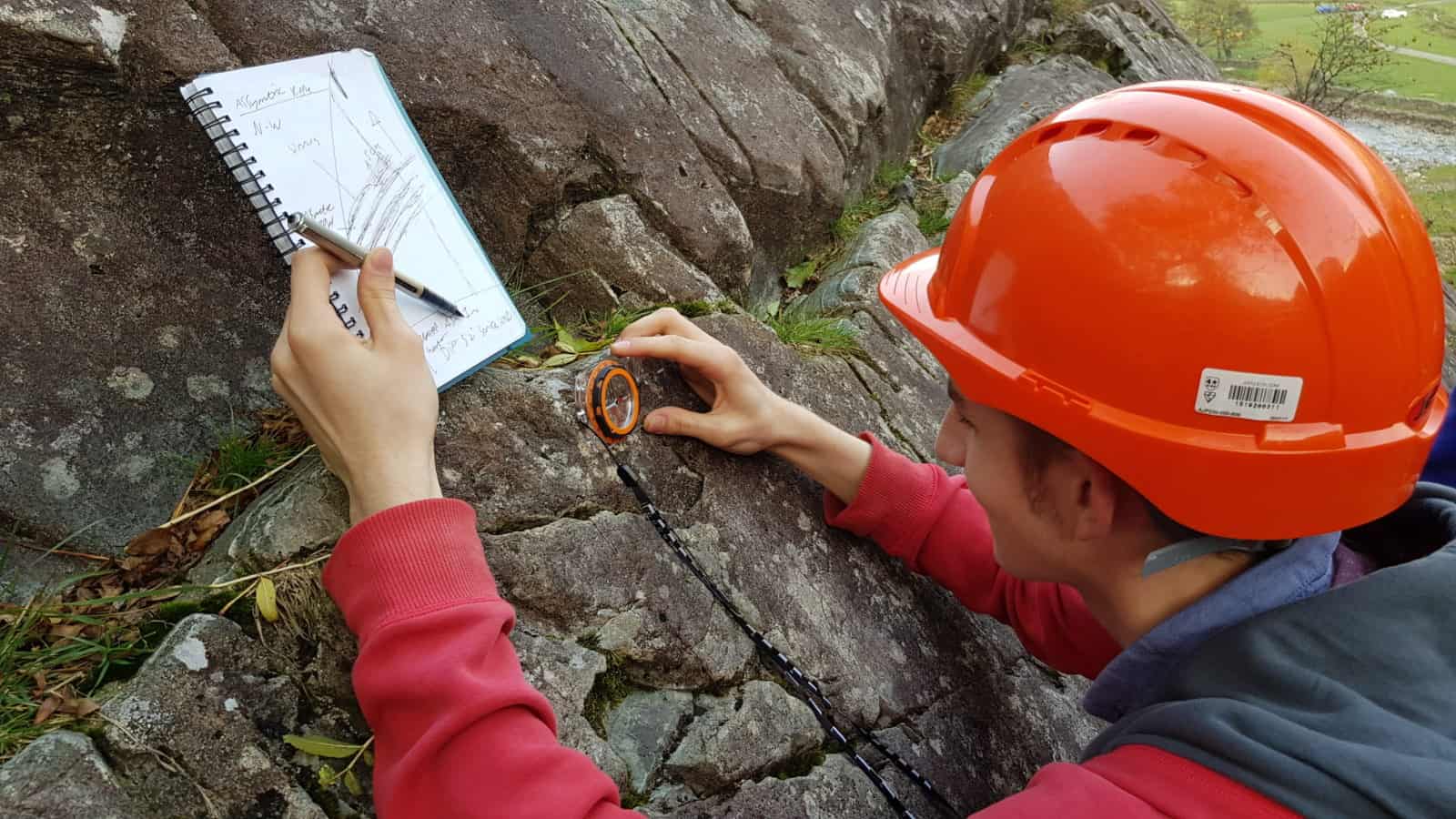
- Using sampling techniques students will collect data on rock units such as using a compass clinometer to measure dip and strike of planar surfaces or apparent dip of fold sections
- Rock descriptions of units from field observations
Graphic Logs
From their fieldwork measurements and full rock descriptions students will construct a graphic log for this geological exposure.
Morning and Afternoon
Evening Workshop
Orientation data will be recorded on tablets using ArcGIS online, and bedrock geology from the BGS will be imported to create a geological map synthesising their own field data with a large secondary data source. Students will present their ideas for the geological history of this outcrop, using secondary sources to back up their primary data.
Day 3
Morning and Afternoon
PAG 6 Investigating Sedimentary Processes
Students will collect/access sediment samples from a range of present day depositional environments (river bed, sand dunes, beach). Students will make qualitative descriptions of these environments of deposition. Evidence collected will help students piece together paleo-depositional environments of sedimentary rock units in the local area.
Visiting sedimentary rock units in the local area, students will further hone their skills:
- Students will locate the geological feature in the local area
- Through field observations, sketches and photographs (including the use of fiducial scale) students will identify geological structures present in the outcrop
- Using sampling techniques students will collect data on rock units such using a compass clinometer to measure dip and strike of planar surfaces or apparent dip of fold sections
Evening
Independent Titles and Secondary Research
During this evening session, students will independently finalise the draft titles of their investigation. Teachers will have the opportunity to confirm that students’ titles have the potential to meet the assessment criteria and provide any general guidance necessary. Students will develop their justification and contextualisation of how their enquiry will help them answer their title. In addition, using FSC databases and research facilities, students will independently select any secondary data sources they may require.
Day 4
Morning and Afternoon
PAG 6 Investigating geological sequences
Students will visit a different location to further develop their skills in a field based investigation of an outcrop to determine geochronology and process of deposition and/or rock emplacement.
OR
PAG 5 Investigating fossils
Students will visit a local fieldwork site and study fossils in-situ.
OR
PAG 7 Investigating orogenic processes
Studying units of rocks, students will investigate the impact of mountain building events on the local area.
Evening
PAG 12 Research Skills
Students will use their personal geological understanding of the local area and secondary data to understand the paleo-environments and geological history of a local area.
This will then inform their planning of a practical investigation PAG 11.
Day 5
Morning
PAG 11 Investigation
Students will carry out their investigations applying their design investigative approaches and methods to practical work.
Afternoon
A final farewell from our staff as the students depart.
Added value of this course
Develop skills
- Communication | Resilience | Independent thinking | Leadership
- Numeracy | Literacy | Investigative skills | Observation
Enhance Knowledge
- Ask questions.
- Apply knowledge in the real world and make links.
- Make sense of new places and understand our place and role within this.
Enjoy
- Have fun | Make friendships | Connect with nature

