Preston Montford Field Centre is situated on the River Severn, 8km west of Shrewsbury. To the south lie the Shropshire Hills, where a full sequence of deposits from Pre-Cambrian to Carboniferous may be examined. The north Shropshire Plain is lower lying and comprises younger rocks, mainly Permo-Triassic and Triassic, with a thick layer of drift deposits.
This course provides an opportunity for schools with low student numbers to tackle different fieldwork enquiries across a range of dynamic habitats.
These courses are for groups of 9 or less students from any one school. Students must be accompanied by a responsible adult (usually a teacher from a school, but could be a parent/carer for an individual student).
The course price includes in-course transport, whilst at the centre, and is exempt from VAT.
Please bring your own packed lunch for the first day. All other meals are included up to a packed lunch on the last day.
Read more
Each fieldwork day is set up as an investigation, with the students making observations and taking measurements in the field in order to draw conclusions and, where appropriate, gather evidence to prove or disprove hypotheses.
Some of the locations that we may visit include:
Nesscliffe a Triassic Sandstone outcrop
Large quarried outcrop of Triassic Sandstone with lithological differences, bedding structures, joints. Some basic measurements.
Llanymynech and Dolgoch Quarries in Lower Carboniferous Limestone
Bedding structures, lithology and fossils.
Longmyndian-Ordovician of the western Long Mynd
Observation on the West side of the Longmynd syncline and investigating the overlying unconformable Ordovician succession of the Shropshire orefield.
Poles Coppice Quarry
Bedding and structural features.
Examination of minerals spoil at The Bog and Snailbeach mines.
Observation and description of plunging fold axis in the Hope Valley.
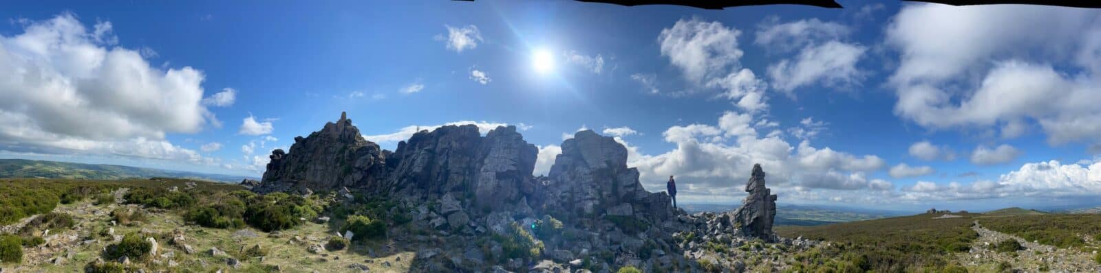
Stiperstones
Identification of bedding and structural features at an unconformity
Bridges
Observations on steeply bedded sediments
Exposure location using traditional navigation methods Rock sample description, measurements of dip strike and jointing, field sketching, outcrop interpretation
Longmyndian succession around Carding Mill Valley
Observation and interpretation of the wider landscape and a visit to various exposures. A study of a dipping rock sequence with facies variation from conglomerate to siltstone. Landscape development and impact of tectonic faulting suggested by an outcrop of younger rocks, sometimes with fossils. Exposure location using traditional navigation methods Rock sample description, measurements of dip strike and jointing., field sketching, outcrop interpretation.
Volcanics, intrusions and an unconformity or two
Many puzzles to solve- identification of basal unconformity, description and measurement of ripple marks, estimating throw of a fault, measurement and observations at a possible metamorphic aureole, unconformity identification from bedding data
What's Included
-
 Expert Tuition
 -
 Free Wi-Fi
 -
 Full Board Accommodation
 -
 Hot and Cold Drinks
 -
 In Course Transport
 -
 Picnic Lunch
Opportunities to attend this course
This course is not currently available to book. Dates will follow soon.
Sign up to our Email Newsletter