
Complete the fieldwork requirements for A level students within physical and human environments.
The 5 day course length works within requirements from Awarding Organisations to allow students to explore a variety of topics and locations, as well as allowing sufficient individual planning time prior to completing data collection. There is an expectation that students will have been introduced to the NEA and completed research into topics and locations prior to arrival.
Students will spend time forming an independent investigation and collecting data for their independent investigation, worth 20% of their final A-level marks.
What can you expect from our tutors?
- Guided exploration of the focus for potential enquiry
- Introduction to a wide range of techniques, methodologies and concepts for fieldwork
- Constructive feedback and questioning of student’s ideas
- Clear communication of what makes a successful investigation
- Workshop sessions in data analysis and GIS
- Organisation of logistics for students’ fieldwork and organisation of safety cover
What can’t tutors do?
- Provide directed exemplar studies for students, as they might do for AS or GCSE work
- Provide lists of titles
- Approve students’ proposals. Only a student’s teacher can do this.
- Teach significant areas of subject content: this is not feasible to do at the same time as students are expected to be demonstrating independence.
Example Timetable
Day 1
Arrive Midday
Students will be greeted by staff, with a welcome talk followed by a brief tour of the centre and the local area.
Outline of the course
Allocation of wellies/waterproofs.
Afternoon
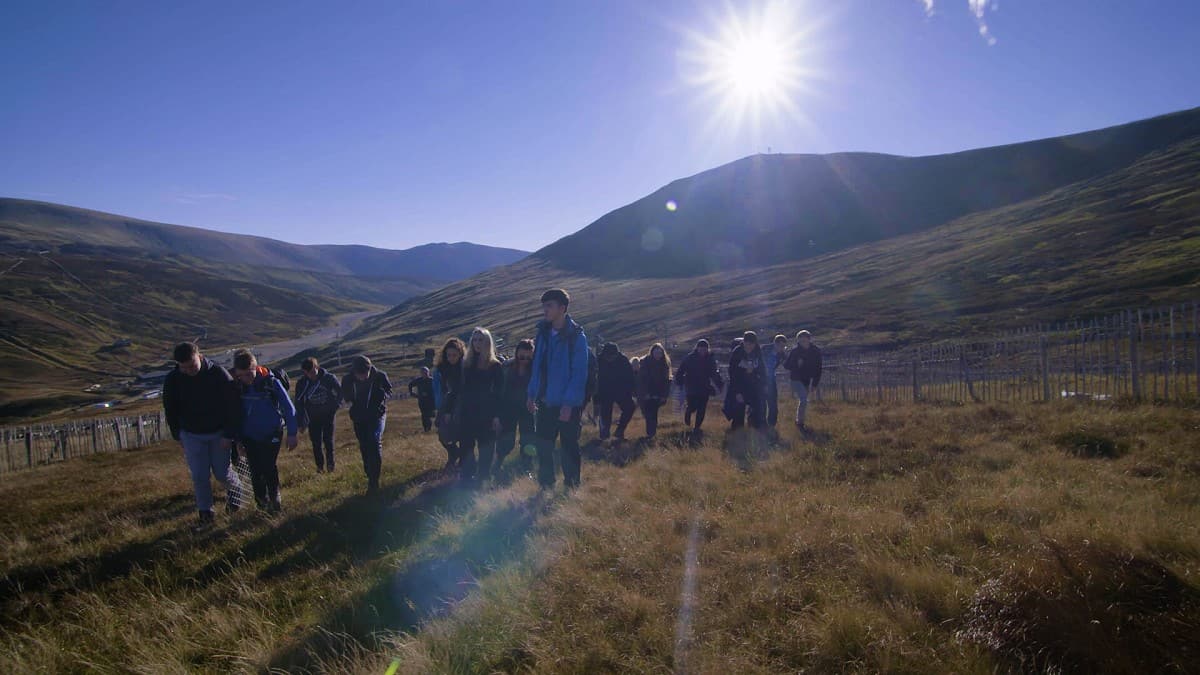
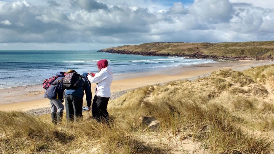
Fieldwork environment / Topic (1)
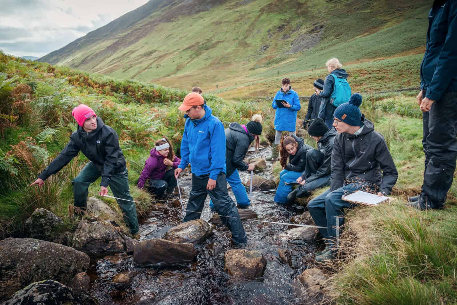
Following the enquiry approach, students will visit a local field site for guided exploration of a range of NEA methodologies and sampling strategies applicable to that topic and area. These can be critically evaluated and adapted to their own investigation.
Topics may include: Coasts / Water Cycles / Carbon Cycles / Place / Glaciation
Evening
NEA Skills Workshop and Follow Up
Students will be given the opportunity to build on skills to assist them in their NEA.
Workshops may include one or a combination of the following: Planning and question writing / Qualitative analysis (e.g. coding) / Quantitative analysis (e.g. statistics) / Data presentation / Geographical Information Systems (GIS) / Using secondary research sets
Day 2
Morning and Afternoon
Fieldwork environment / Topic (2 and 3)
Following the enquiry approach, students will visit a local field site for guided exploration of a range of NEA methodologies and sampling strategies applicable to that topic and area. These can be critically evaluated and adapted to their own investigation.
Topics may include: Coasts / Water Cycles / Carbon Cycles / Place /Glaciation (Centre dependent)
Evening
NEA Skills Workshop and Follow Up
Students will be given the opportunity to build on skills to assist them in their NEA.
Workshops may include one or a combination of the following: Planning and question writing / Qualitative analysis (e.g. coding) / Quantitative analysis (e.g. statistics) / Data Presentation / Geographical Information Systems (GIS) / Using secondary research sets
Day 3
Morning
Fieldwork environment / Topic (4)
Following the enquiry approach, students will visit a local field site for guided exploration of a range of NEA methodologies and sampling strategies applicable to that topic and area. These can be critically evaluated and adapted to their own investigation.
Topics may include: Coasts / Water Cycles /Carbon Cycles / Place/Glaciation
Afternoon and Evening
NEA Planning
Choosing an area/topic that has been visited in the week, and an interest focus from the student that links to the specification, students will individually plan their own NEA investigation.
All awarding organisations stipulate that students must complete their proposal forms prior to their fieldwork. To make the most of this time, we would advise that students arrive at the start of the course with drafted proposal forms. This will allow the planning time to be used to refine and amend these forms following the fieldwork skills development sessions, during which students will have trialled fieldwork methods and visited fieldwork sites.
Day 4
Morning and Afternoon
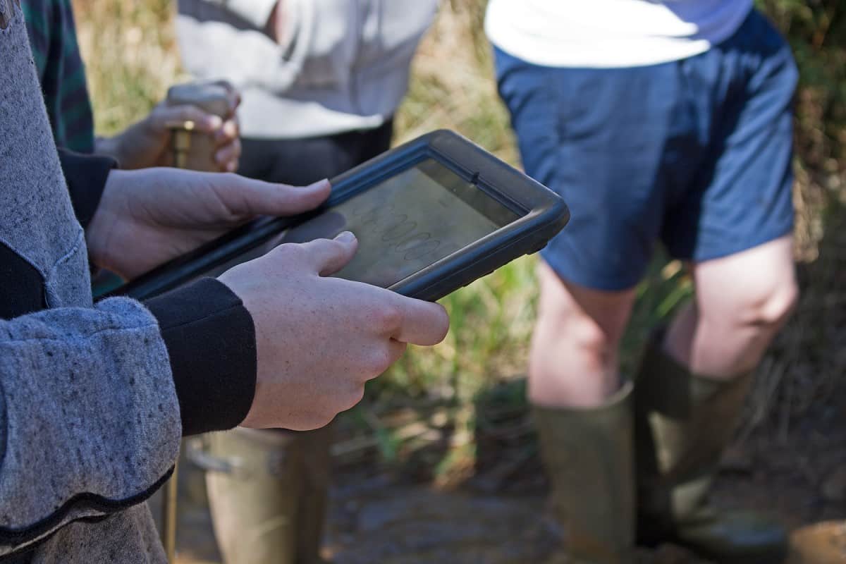
NEA Data Collection
Students will spend the day in their chosen location collecting the data they require, they may work individually or in groups, supervised by our tutors and school staff.
In order to collect data on this course/programme, groups of students may need to carry out fieldwork independently. At times this may be under remote supervision (Groups Under Remote Supervision- or GURS).
In order to give the students the broadest experience, this programme can be delivered with visiting school staff assisting with supervision of GURS. This is not essential, but will enable us to maximise the number of sites accessed for students to collect their own data. If you wish to use this option, please discuss this with us before your visit, and fill out the agreement on p.18 of the Customer Information document.
Evening
Outdoor Activity (weather and time of year dependent)
Students have the opportunity to celebrate their hard work over the prior days with an evening activity.
Day 5
Morning
NEA Skills Workshop and Follow Up
Students will begin to individually process their NEA data. There is also an opportunity to complete an skills workshops not completed prior in the week.
Workshops may include one or a combination of the following: Planning and question writing / Qualitative analysis (e.g. coding) / Quantitative analysis (e.g. statistics) / Data Presentation / Geographical Information Systems (GIS) / Using secondary research sets
Depart at Midday
A final farewell from our staff as the students depart at midday
Please note: to ensure safe and quality learning experiences for students, the timetable may alter depending on weather conditions and local factors at centres.
How this course fulfills the specification
AQA
3.3 Geography Investigation worth 20% of final A level marks.
3.1 Physical geography
3.1.1 Water and carbon cycles
3.1.1.1 Water and carbon cycles as natural systems
3.1.1.2 The water cycle
3.1.1.3 The carbon cycle
3.1.1.4 Water, carbon, climate and life on Earth
3.1.1.6 Case studies: Case study of a river catchment(s) at a local scale to illustrate and analyse the key themes above, engage with field data and consider the impact of precipitation upon drainage basin stores and transfers and implications for sustainable water supply and/or flooding.
3.1.3 Coastal systems and landscapes
3.1.3.1 Coasts as natural systems
3.1.3.2 Systems and processes
3.1.3.3 Coastal landscape development
3.1.3.4 Coastal management
3.1.3.6 Case studies: Case study(ies) of coastal environment(s) at a local scale to illustrate and analyse fundamental coastal processes, their landscape outcomes as set out above and engage with field data and challenges represented in their sustainable management.
3.1.4 Glacial systems and landscapes
3.1.4.1 Glaciers as natural systems
3.1.4.3 Systems and processes
3.1.4.4 Glaciated landscape development
3.1.6 Ecosystems under stress
3.1.6.1 Ecosystems and sustainability
3.1.6.2 Ecosystems and processes
3.1.6.4 Ecosystems in the British Isles over time
3.1.6.6 Local ecosystems
3.1.6.7 Case studies: Case study of a specified ecosystem at a local scale to illustrate and analyse key themes set out above, including the nature and properties of the ecosystem, human impact upon it and the challenges and opportunities presented in its sustainable development.
3.2.4 Population and the environment
3.2.4.2 Environment and population: Characteristics and distribution of two key zonal soils to exemplify relationship between soils and human activities especially agriculture. Soil problems and their management as they relate to agriculture: soil erosion, waterlogging, salinisation, structural deterioration.
3.2.4.7 Case studies: Case study of a specified local area to illustrate and analyse the relationship between place and health related to its physical environment, socio-economic character and the experience and attitudes of its populations.
3.2 Human geography
3.2.2 Changing places
3.2.2.1 The nature and importance of places
3.2.2.2 Changing places – relationships, connections, meaning and representation
3.2.2.4 Place studies
3.2.3 Contemporary urban environments
3.2.3.1 Urbanisation
3.2.3.2 Urban forms
3.2.3.3 Social and economic issues associated with urbanisation
3.2.3.4 Urban climate
3.2.3.5 Urban drainage
3.2.3.6 Urban waste and its disposal
3.2.3.7 Other contemporary urban environmental issues
3.2.3.8 Sustainable urban development
3.2.3.9 Case studies:Case studies of two contrasting urban areas to illustrate and analyse key themes set out above, to include:• patterns of economic and social well-being• the nature and impact of physical environmental conditions.with particular reference to the implications for environmental sustainability, the character of the study areas and the experience and attitudes of their populations.
3.2.5 Resource security
3.2.5.3 Water security
3.2.5.4 Energy security
Edexcel
Independent investigation, worth 20% of their final A-level marks.
Area of study 1: Dynamic Landscapes
Topic 2: Landscape Systems, Processes and Change
Option 2A: Glaciated Landscapes and Change
Enquiry question 1: How has climate change influenced the formation of glaciated landscapes over time?
2A.3 Periglacial processes produce distinctive landscapes.
Enquiry question 2: What processes operate within glacier systems?
2A.6 The glacier landform system.
Enquiry question 3: How do glacial processes contribute to the formation of glacial landforms and landscapes?
2A.7 Glacial erosion creates distinctive landforms and contributes to glaciated landscapes.
2A.8 Glacial deposition creates distinctive landforms and contributes to glaciated landscapes.
2A.9 Glacial meltwater plays a significant role in creating distinctive landforms and contributes to glaciated landscapes.
Enquiry question 4: How are glaciated landscapes used and managed today?
2A.10 Glacial and periglacial landscapes have intrinsic cultural, economic and environmental value.
2A.11 There are threats facing fragile active and relict glaciated upland landscapes.
Option 2B: Coastal Landscapes and Change
Enquiry question 1: Why are coastal landscapes different and what processes cause these differences?
2B.1 The coast, and wider littoral zone, has distinctive features and landscapes.
2B.2 Geological structure influences the development of coastal landscapes at a variety of scales.
2B.3 Rates of coastal recession and stability depend on lithology and other factors.
Enquiry question 2: How do characteristic coastal landforms contribute to coastal landscapes?
2B.4 Marine erosion creates distinctive coastal landforms and contributes to coastal landscapes.
2B.5 Sediment transport and deposition create distinctive landforms and contribute to coastal landscapes.
2B.6 Subaerial processes of mass movement and weathering influence coastal landforms and contribute to coastal landscapes.
Enquiry question 3: How do coastal erosion and sea level change alter the physical characteristics of coastlines and increase risks?
2B.8 Rapid coastal retreat causes threats to people at the coast.
2B.9 Coastal flooding is a significant and increasing risk for some coastlines.
Enquiry question 4: How can coastlines be managed to meet the needs of all players?
2B.10 Increasing risks of coastal recession and coastal flooding have serious consequences for affected communities.
2B.11 There are different approaches to managing the risks associated with coastal recession and flooding.
2B.12 Coastlines are now increasingly managed by holistic integrated coastal zone management (ICZM).
Area of study 3: Physical Systems and Sustainability
Topic 5: The Water Cycle and Water Insecurity
Enquiry question 1: What are the processes operating within the hydrological cycle from global to local scale?
5.2 The drainage basin is an open system within the global hydrological cycle.
5.3 The hydrological cycle influences water budgets and river systems at a local scale.
Enquiry question 2: What factors influence the hydrological system over short- and long-term timescales?
5.4 Deficits within the hydrological cycle result from physical processes but can have significant impacts.
5.5 Surpluses within the hydrological cycle can lead to flooding, with significant impacts for people.
5.6 Climate change may have significant impacts on the hydrological cycle globally and locally.
Topic 6: The Carbon Cycle and Energy Security
Enquiry question 1: How does the carbon cycle operate to maintain planetary health?
6.1 Most global carbon is locked in terrestrial stores as part of the long-term geological cycle.
6.2 Biological processes sequester carbon on land and in the oceans on shorter timescales.
6.3 A balanced carbon cycle is important in sustaining other earth systems but is increasingly altered by human activities.
Enquiry question 2: What are the consequences for people and the environment of our increasing demand for energy?
6.6 There are alternatives to fossil fuels but each has costs and benefits.
Enquiry question 3: How are the carbon and water cycles linked to the global climate system?
6.7 Biological carbon cycles and the water cycle are threatened by human activity.
6.8 There are implications for human wellbeing from the degradation of the water and carbon cycles.
6.9 Further planetary warming risks large-scale release of stored carbon, requiring responses from different players at different scales
Area of study 2: Dynamic Places
Topic 4: Shaping Places
Option 4A: Regenerating Places
Enquiry question 1: How and why do places vary? An in-depth study of the local place in which you live or study and one contrasting place
4A.1 Economies can be classified in different ways and vary from place to place.
4A.2 Places have changed their function and characteristics over time.
4A.3 Past and present connections have shaped the economic and social characteristics of your chosen places.
Enquiry question 2: Why might regeneration be needed?
4A.4 Economic and social inequalities changes people’s perceptions of an area.
4A.5 There are significant variations in the lived experience of place and engagement with them.
4A.6 There is a range of ways to evaluate the need for regeneration.
Enquiry question 3: How is regeneration managed?
4A.7 UK government policy decisions play a key role in regeneration.
4A.8 Local government policies aim to represent areas as being attractive for inward investment.
4A.9 Rebranding attempts to represent areas as being more attractive by changing public perception of them.Enquiry question 4: How successful is regeneration?
4A.10 The success of regeneration uses a range of measures: economic, demographic, social and environmental.
4A.11 Different urban stakeholders have different criteria for judging the success of urban regeneration.
4A.12 Different rural stakeholders have different criteria for judging the success of rural regeneration.
Option 4B: Diverse Places
Enquiry question 2: How do different people view diverse living spaces?
4B.4 Urban places are seen differently by different groups because of their lived experience of places and their perception of those places.
4B.5 Rural places are seen differently by different groups because of their lived experience of places and their perception of those places.
4B.6 There is a range of ways to evaluate how people view their living spaces.
Enquiry question 4: How successfully are cultural and demographic issues managed?
4B.10 The management of cultural and demographic issues can be measured using a range of techniques.
4B.11 Different urban stakeholders have different criteria for assessing the success of managing change in diverse urban communities.
4B.12 Different rural stakeholders have different criteria for assessing the success of managing change in diverse rural communities
Eduqas
Component 4: Independent Investigation worth 20% of their final A level marks.
2.1 Component 1
SECTION A - Changing Landscapes
1.1: Coastal Landscapes
1.1.1 The operation of the coast as a system
1.1.2 Temporal variations and their influence on coastal environments
1.1.3 Landforms and landscape systems, their distinctive features and distribution
1.1.4 Factors affecting coastal processes and landforms
1.1.5 Processes of coastal weathering, mass movement, erosion and the characteristics and formation of associated landforms and landscapes
1.1.6 Processes of coastal transport and deposition and the characteristics and the formation of associated landforms and landscapes
1.1.7 Aeolian, fluvial and biotic processes, the characteristics and the formation of landforms in coastal environments
1.1.8 Variations in coastal processes, coastal landforms and landscapes over different time scales
1.1.9 Coastal processes are a vital context for human activity
1.1.10 The impact of human activity on coastal landscape systems
1.2: Glaciated Landscapes
1.2.1 The operation of a glacier as a system
1.2.5 Processes of glacial weathering, erosion and the characteristics and the formation of associated landforms and landscapes
1.2.6 Processes of glacial and fluvioglacial transport and glacial and fluvioglacial deposition and the characteristics and the formation of associated landforms and landscapes
1.2.8 Periglacial processes and the formation of associated features
1.2.10 Glacial processes are a vital context for human activity
2.2 Component 2
SECTION A - Global Systems
2.1: Water and Carbon Cycles
2.1.2 Catchment hydrology – the drainage basin as a system
2.1.3 Temporal variations in river discharge
2.1.4 Precipitation and excess runoff within the water cycle
2.1.5 Deficit within the water cycle
2.1.7 Carbon stores in different biomes
2.1.8 Changing carbon stores in peatlands over time
2.1.9 Links between the water and carbon cycles
2.1.10 Feedback within and between the carbon and water cycles
2.3 Component 3
SECTION B - Contemporary Themes in Geography
3.2: Ecosystems
3.2.1 The value and distribution of ecosystems
3.2.2 The structure and functioning of ecosystems3.2.3 Biodiversity under threat
3.2.4 Conserving biodiversity
3.2.5 Ecosystems at a local scale
3.5: Weather and Climate
3.5.3 Climate and weather of the UK
3.5.4 Extreme weather events
3.5.5 Impacts and management of climatic hazards
3.5.6 Impacts of human activities on the atmosphere at local and regional scales
3.5.7 People, climate and the future
2.1 Component 1
SECTION B - Changing Places
1.3: Changing Places
1.3.1 Changing place; changing places – relationships and connections
1.3.2 Changing place; changing places – meaning and representation
1.3.3 Changes over time in the economic characteristics of places
1.3.4 Economic change and social inequalities in deindustrialised urban places
1.3.5 The service economy (tertiary) and its social and economic impacts
1.3.6 The 21st century knowledge economy (quaternary) and its social and economic impacts
1.3.7 The rebranding process and players in rural places
1.3.8 Rural management and the challenges of continuity and change
1.3.9 The rebranding process and players in urban places
1.3.10 Urban management and the challenges of continuity and change
2.2 Component 2
SECTION B - Global Governance: Change and Challenges
2.2: Global Governance: Change and Challenges
2.2.6 to 2.2.10: Global Governance of the Earth’s Oceans
2.2.9 Managing marine environments
2.2.10 Managing ocean pollution
OCR
Investigative geography; worth 20% of final A-level mark.
2c: Content of Physical systems (H481/01)
Topic 1.1 - Landscape Systems
1.1.1 Option A - Coastal Landscapes
1. How can coastal landscapes be viewed as systems?
1.a Coastal landscapes can be viewed as systems.
1.b Coastal landscape systems are influenced by a range of physical factors.
1.c Coastal sediment is supplied from a variety of sources.
2. How are coastal landforms developed?
2.a Coastal landforms develop due to a variety of interconnected climatic and geomorphic processes.
2.b Coastal landforms are inter-related and together make up characteristic landscapes.
4. How does human activity cause change within coastal landscape systems?
4.a Human activity intentionally causes change within coastal landscape systems.
4.b Economic development unintentionally causes change within coastal landscape systems.
1.1.2 Option B - Glaciated Landscapes
1. How can glaciated landscapes be viewed as systems?
1.a Glaciated landscapes can be viewed as systems.
1.b Glaciated landscapes are influenced by a range of physical factors.
1.c There are different types of glacier and glacier movement.
2. How are glacial landforms developed?
2.a Glacial landforms develop due to a variety of interconnected climatic and geomorphic processes.
2.b Glacial landforms are inter-related and together make up characteristic landscapes.
3. How do glacial landforms evolve over time as climate changes?
3.a Glacio-fluvial landforms exist as a result of climate change at the end of glacial periods.
3.b Periglacial landforms exist as a result of climate change before and/or after glacial periods.
4. How does human activity cause change within glaciated and periglacial landscape systems?
4.a Human activity causes change within periglacial landscape systems.
Topic 1.2 - Earth’s Life Support Systems
1. How important are water and carbon to life on earth?
1.a Water and carbon support life on earth and move between the land, oceans and atmosphere.
1.b The carbon and water cycles are systems with inputs, outputs and stores.
1.c The carbon and water cycles have distinctive processes and pathways that operate within them.
3. How much change occurs over time in the water and carbon cycles?
3.a Human factors can disturb and enhance the natural processes and stores in the water and carbon cycles.
3.b The pathways and processes which control the cycling of water and carbon vary over time.
4. To what extent are the water and carbon cycles linked?4.a The two cycles are linked and interdependent.
4.b The global implications of water and carbon management.
2c: Content of Geographical debates (H481/03)
Topic 3.1 - Climate Change
4. In what ways can humans respond to climate change?
4.c Mitigation and adaptation are complementary strategies for reducing and managing the risks of climate change.
Topic 3.3 - Exploring Oceans
2. What are the opportunities and threats arising from the use of ocean resources?
2.a Biological resources within oceans can be used in sustainable or unsustainable ways.
2.b The use of ocean energy and mineral resources is a contested issue.
2.c Governing the oceans poses issues for the management of resources.
3. How and in what ways do human activities pollute oceans?
3.a There are a variety of pollutants that affect the ocean system.
3.b Off-shore oil production and transport poses threats for people and the environment.
4. How is climate change impacting the ocean system?
4.a Climate change is altering the nature of the ocean’s water.
4.b Climate change is altering sea levels.
Topic 3.4 - Future of Food
1. What is food security and why is it of global significance?
1.b Food is a precious resource and global food production can be viewed as an interconnected system.
4. How do food production and security issues impact people and the physical environment?
4.a Imbalance in the global food system has physical and human impacts
2c: Content of Human interactions (H481/02)
Topic 2.1 - Changing Spaces; Making Places
1. What’s in a place?
1.a Places are multi-faceted, shaped by shifting flows and connections which change over time.
2. How do we understand place?
2.a People see, experience and understand place in different ways, this can also change over time.
2.b Places are represented through a variety of contrasting formal and informal agencies.
3. How does economic change influence patterns of social inequality in places?
3.a The distribution of resources, wealth and opportunities are not evenly spread within and between places.
3.b Processes of economic change can create opportunities for some while creating and exacerbating social inequality for others.
3.c Social inequality impacts people and places in different ways.
4. Who are the players that influence economic change in places?
4.a Places are influenced by a range of players operating at different scales.
5. How are places created through placemaking processes?
5.a Place is produced in a variety of ways at different scales.
5.b The placemaking process of rebranding constructs a different place meaning through reimaging and regeneration.
5.c Making a successful place requires planning and design.
Added value of this course
Develop skills
- Communication | Resilience | Independent thinking | Leadership
- Numeracy | Literacy | Investigative skills | Observation
Enhance Knowledge
- Ask questions.
- Apply knowledge in the real world and make links.
- Make sense of new places and understand our place and role within this.
Enjoy
- Have fun | Make friendships | Connect with nature
Why Choose Field Studies Council?
-

Expert tuition by fully trained staff
-

Stunning locations across the UK
-

Outstanding curriculum knowledge
-

Rigorous health and safety procedures
-

Support before and after your visit
-

Free places for visiting staff