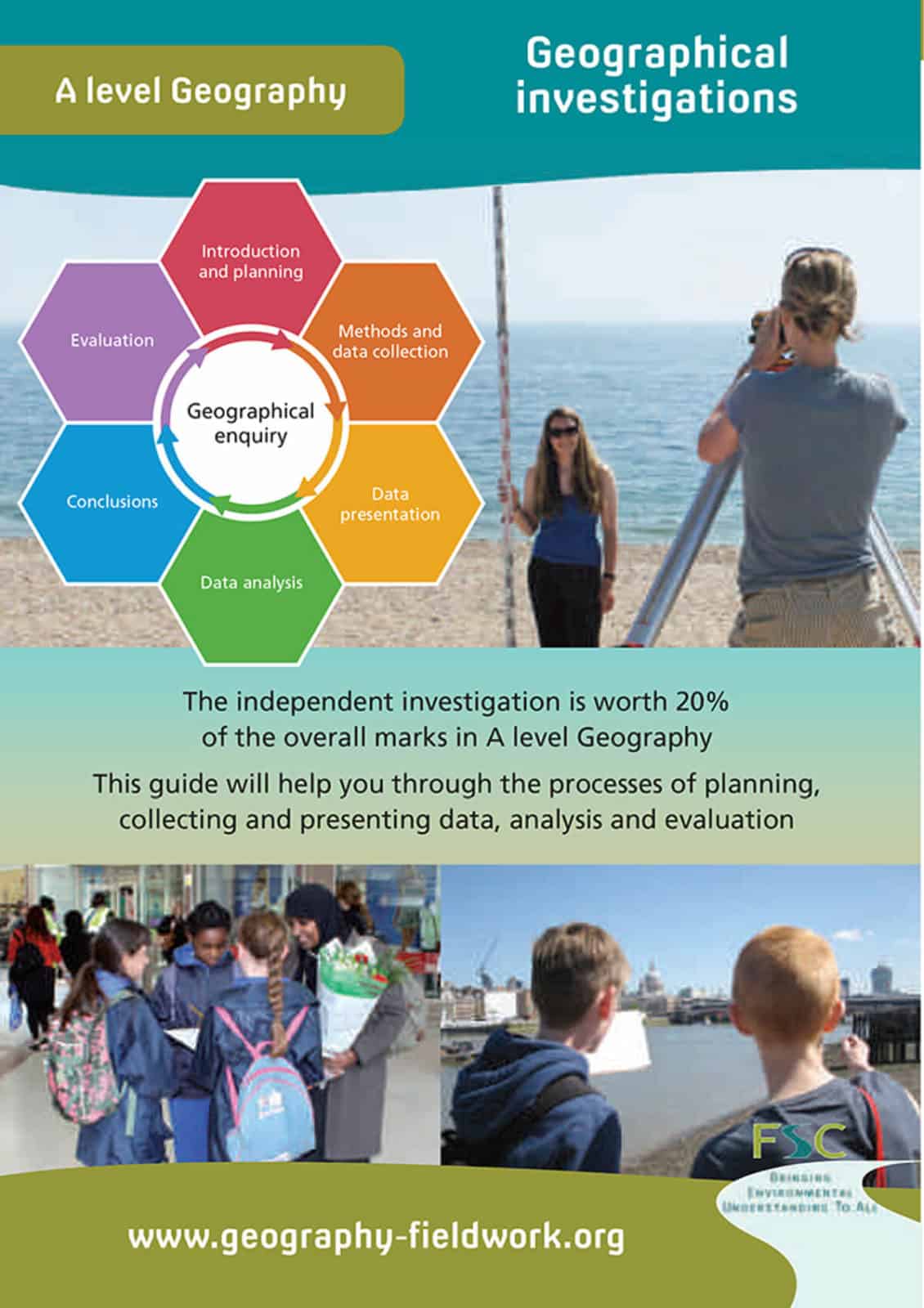
Geographical investigations
Geographical investigations is a desk-top reference guide for each student. With concise definitions of key terms and concepts, it support students through the process of planning, collecting and presenting data, analysis and evaluation.
- Introduction and planning. Enquiries are driven by curiosity. What would you like to know about that would involve you doing some research of your own?
- Methods and data collection. Both qualitative and quantitative methods. Types of variables, measurement scales and sampling.
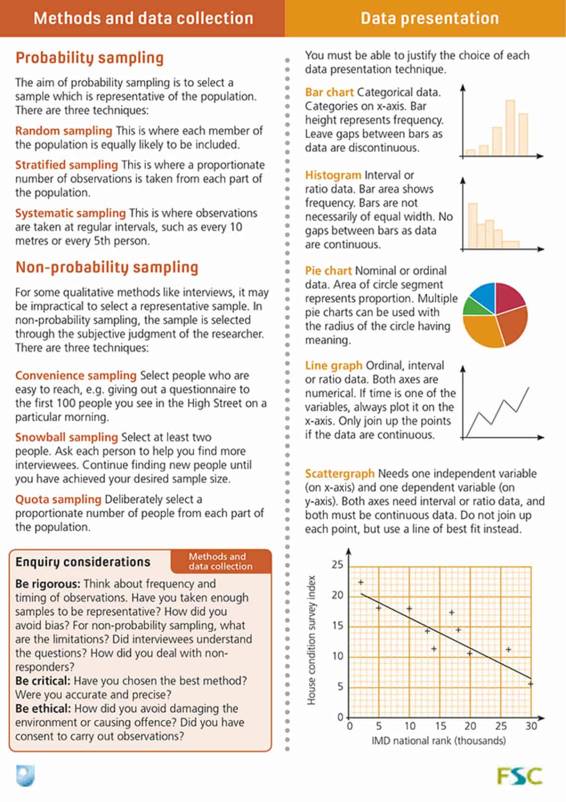
- Data presentation. Bar chart, histogram, line graph, pie chart and scattergraph. Normal distributions. Both measures of central tendency (mean, mode and median) and dispersion (standard deviation and interquartile range).
- Data analysis. Statistical testing (Spearman’s Rank, Chi squared and Mann-Whitney U tests).
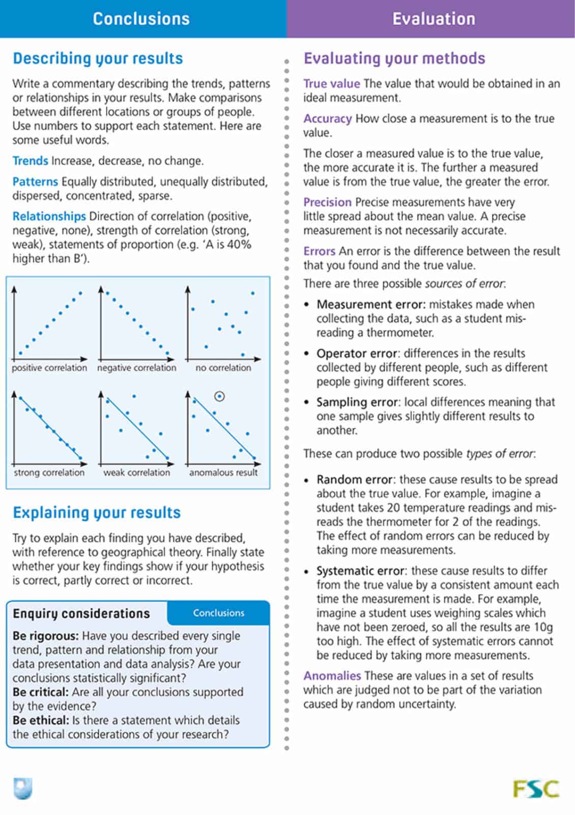
- Conclusions. Scaffolding the language of trends, patterns and relationships.
- Evaluation. Accuracy, precision and errors.
The independent investigation is worth 20% of the marks in A level Geography.