What are lowland glacial landscapes like?
All glacial landforms in the British Isles are fossil landforms. Although the exact number of glacial and interglacial periods in the British Isles is still a matter of scientific debate, the relict landforms which can most easily be studied in the field were heavily modified by glacial erosion and deposition in the Devensian period, at its maximum extent 18,000 years before present. At this time, sea level was 100m lower than today, and land bridges linked Britain to France and Ireland.
What questions do geographers ask?
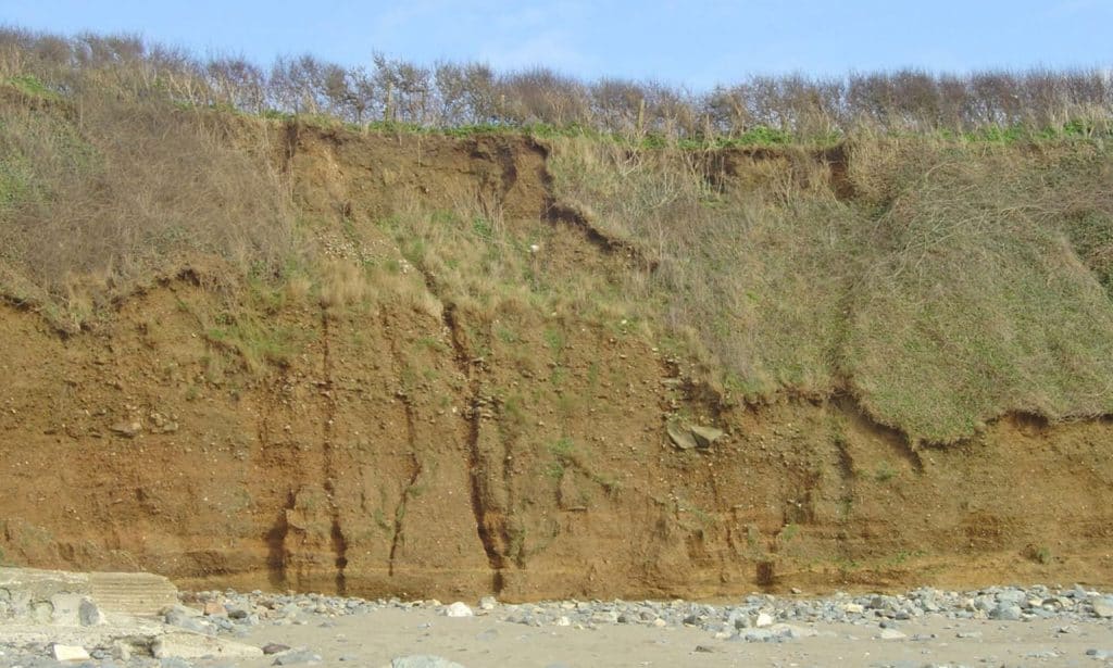
- What are the characteristics of the sediment (size, roundness, degree of sorting, mineral composition)?
- What evidence is there that this is a periglacial deposit?
- What postglacial changes have occurred?
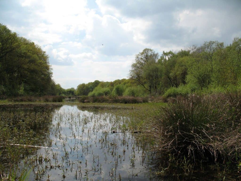
- What was the role of glaciation in the formation of this landscape?
- What postglacial changes have occurred?
- How will this landscape change in the future?
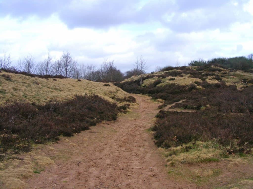
- What are the characteristics of the sediment (size, roundness, degree of sorting, mineral composition)?
- What was the role of glacial meltwater in the formation of this landscape?
- Can you determine the direction of meltwater movement?
You can ask geographical questions about lowland glaciation in much of the UK. Photographs, map views and Google Earth views can help you. Here are some examples.
| Research questions | Sub questions |
|---|---|
| Why is there an uneven distribution of depositional and/or fluvioglacial landforms in the lowland landscape at x? | Where are depositional landforms (like moraines) and/or fluvioglacial landforms (like eskers and kames) in the landscape at x? How was the rate of glacial deposition affected by aspect and altitude? What postglacial changes have occurred? |
| What is the origin of the deposits at x? | What are the characteristics of the sediment (size, roundness, degree of sorting, mineral composition)? To what extent can the characteristics of the sediment be explained by the direction of ice or meltwater movement? What postglacial changes have occurred? |
| What postglacial changes have occurred in the lowland landscape at x? | How has vegetation succession led to changes in kettle holes in landscape x? Is there any evidence that landforms have been modified or destroyed by weathering, erosion and/or human activity? |
Specialised geographical concepts
A good way to demonstrate challenge in your choice of research question and/or sub questions is to consider one or more of the specialised geographical concepts. Here are a few suggestions:
| Specialised concept | Research question or sub question |
|---|---|
| Causality | To what extent has the lowland landscape at x been shaped by glacial deposition? |
| Causality | What has caused variations in drumlin morphology at x? |
| System | Using field evidence to reconstruct the glacial budget for glacial trough y |
Choosing a fieldwork location
A good place to start is the BRITICE Glacial Map of Britain. Maps can be downloaded as pdf files, kmz files for use in Google Earth and ESRI shapefiles for use in GIS applications.
A possible fieldwork region: glacial and fluvioglacial landforms near Telford and Newport in east Shropshire.
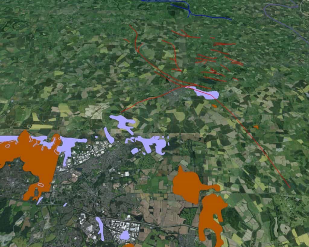
Red lines indicate eskers, orange areas indicate moraine, light purple areas indicate glacial lake deposits.
A good fieldwork site might be 2-3 square kilometres surrounding Aqualate Mere, a kettle hole. What do the eskers and glacial lake deposits suggest about the movement of ice and meltwater? What postglacial changes have happened in the kettle hole?
Secondary and Further Education Courses
Set your students up for success with our secondary school trips and courses. Offering excellent first hand experiences for your students, all linked to the curriculum.
Group Leader and Teacher Training
Centre-based and digital courses for teachers
Experiences for Young People
Do you enjoy the natural world and being outdoors? Opportunities for Young People aged 16-25.