Slope profiling is a technique used measure the angle and distance of a slope. This may be used at the coast to profile a beach or sand dune or a slope on a hill if an investigation into micro climates is being carried out.
To measure the angle of a slope between two points, you need two or three people.
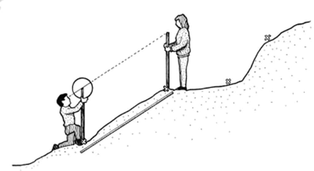
- Identify a slope unit between two breaks of slope. Measure this distance.
- Person A stands at the bottom of the slope with the clinometer resting on top of a ranging pole.
- Person B holds a second ranging pole at the top of the slope.
- Person A sights the clinometer at the top of the ranging pole held by B and reads off the slope angle. The distance and angle can then be recorded.
Angles going uphill are recorded as positive (+) angles and downhill as negative (-) ones. Measuring the angle of a slope at regular intervals is more straightforward, but it tends to hide the small variations in slope which can be important on sand dunes.
Measuring from break of slope to break of slope means that you have to estimate where the slope angles change. This means that you normally end up taking more slope readings, but the profile that you draw is more accurate.

Secondary and Further Education Courses
Set your students up for success with our secondary school trips and courses. Offering excellent first hand experiences for your students, all linked to the curriculum.
Group Leader and Teacher Training
Centre-based and digital courses for teachers