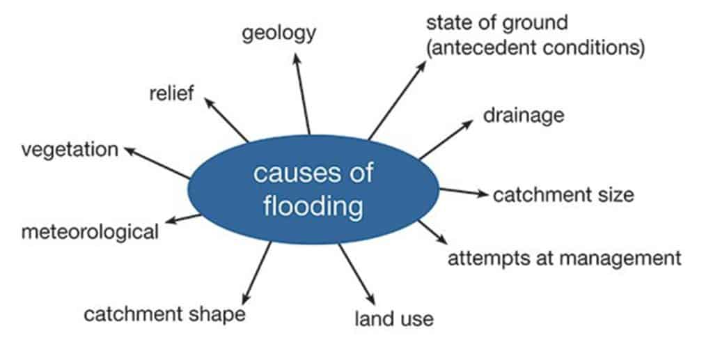
Flooding occurs when the amount of water in a river exceeds the capacity of the channel, causing it to burst its banks onto the flood plain.
“It is apparent that a combination of extreme rainfall events and changes in land use has made flooding more problematic in the UK, resulting in very significant social, economic and environmental costs”
UK National Ecosystem Assessment 2014
What questions do geographers ask?
You can ask geographical questions about flood risk in many drainage basins.
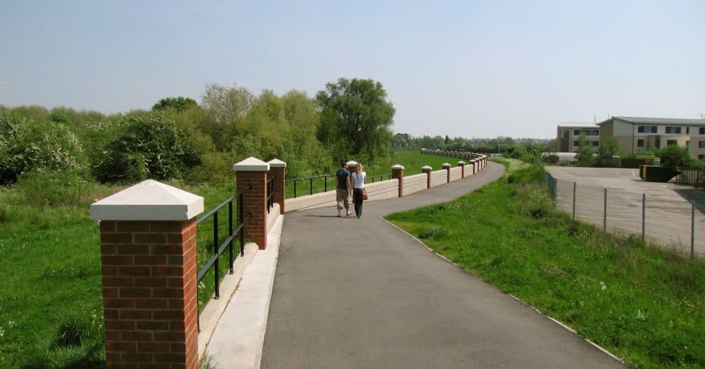
- Why have these flood defences been constructed?
- How do these flood defences reduce the risk of flooding at this location?
- How well will they protect the buildings from flooding over the next 50 years?
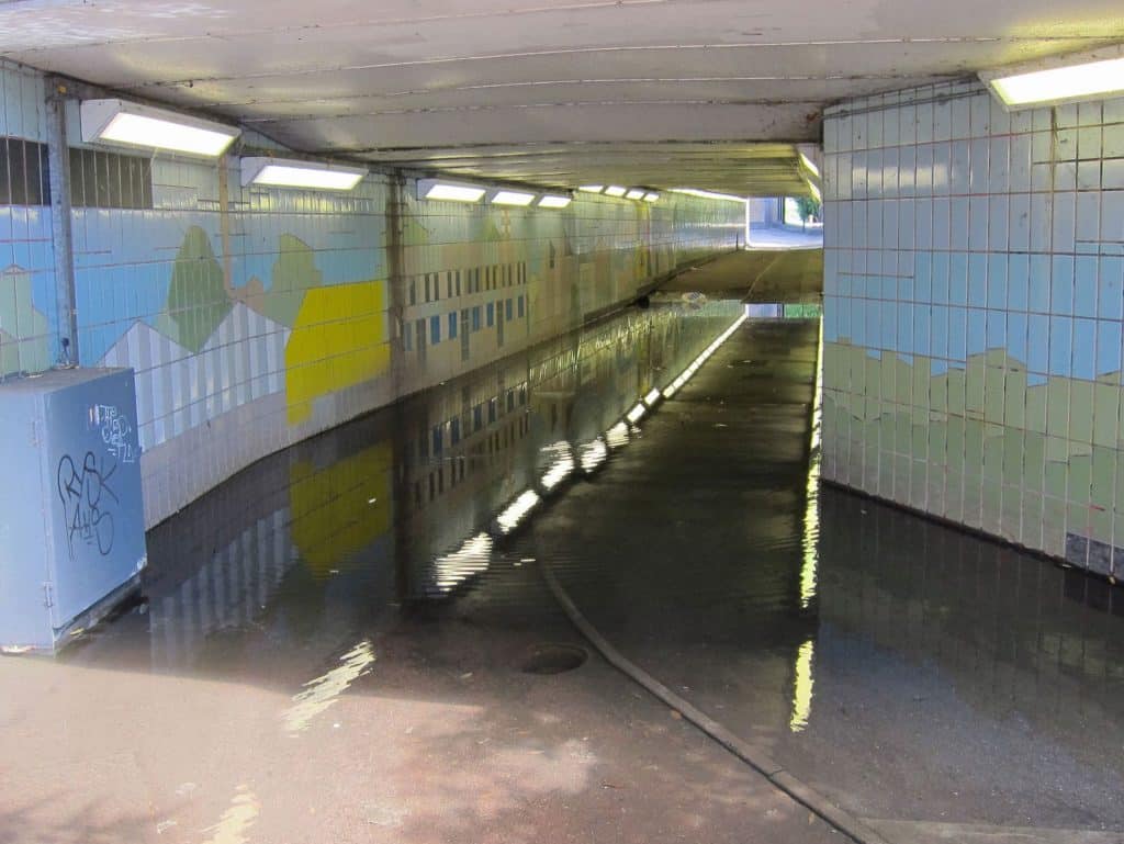
- Are all subways in the local area equally affected by flooding?
- What problems does flooding cause at this location?
- How can the risk of flooding at this location be reduced?
Local news reports are also a good place to start. Here are some examples from 2015.
‘Nightmare’ flooding hits York after rivers overflow 27 December 2015
Cumbria floods: Video diary from Cockermouth 8 December 2015
Substation flooding leaves 55,000 Lancaster homes without power
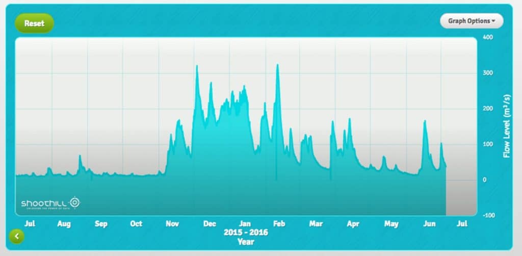
You could use the Shoothill Gauge Map to explore secondary data associated with river discharge.
Farson Digital Watercams operate a network of high definition webcams on the rivers of the UK and Ireland. For example, here is the webcam on the River Ouse in York
Catchment Flood Management Plans have been prepared for all major drainage basins in England. These plans summarise the risks today and 50-100 years into the future, and how these risks might be managed. Browse for the Flood Management Plan for your local area.
Aimed at people living in flood risk areas, the Essential Guide to Flood Planning and Preparation contains helpful information about flooding risks and some practical tips on flood preparation and safety.
What could you investigate by fieldwork?
Here are some examples. Each research question has been split into 2 or 3 sub-questions.
| Research questions | Sub questions |
|---|---|
| What is the impact of the flood defences at x? | Where are the hard defences at x? Is there a difference in land use and value in areas defended by the flood defences and an undefended area? Is there any historical evidence for the difference that the flood defences have made? |
| How sustainable are the river management strategies used at x? | What river management strategies are used at x? What are the costs (e.g. installation, maintenance, expected life) of the strategies used? Do the strategies increase or decrease the risk of flooding elsewhere on the river? |
| Has land use change in area x (e.g. clear felling, changing farming practices) increased or decreased the risk of flooding in town y downstream? | What is the impact of the land use change on the water cycle? Is there a difference in flood frequency magnitude and impact in town y before and after the land use change? To what extent does the land use change explain this change in flood risk? |
Specialised geographical concepts
A good way to demonstrate challenge in your choice of research question and/or sub questions is to consider one or more of the specialised geographical concepts. Here are a few suggestions:
| Specialised concept | Research question or sub question |
| Risk | What factors make town x at risk from flooding? |
| Risk | Which stretches of river x have the highest flood risk? |
| Resilience | How resilient are the flood defences at settlement x to changing weather patterns associated with climate change? |
| Threshold | What is the threshold event for flooding at town x? |
Choosing a fieldwork location
Use the Flood defence maps (Environment Agency) to explore the risk of flooding from rivers plus any flood defences.
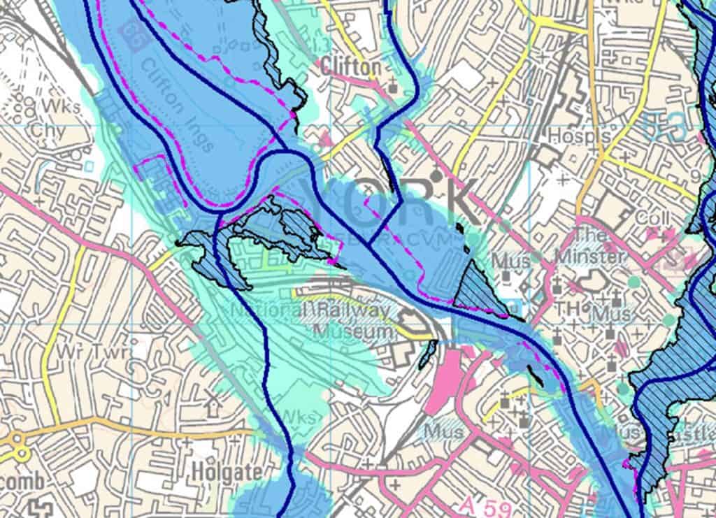
A possible fieldwork location: York. Fieldwork here is practical because there is widespread public access and flood risk varies over an easily walkable small area. Dark blue shows land with a 1% probability of flooding in any particular year. Light blue shows land with a 0.1% probability of flooding in any particular year. Flood defences are shown in purple. Why are some locations more at risk of flooding than others? Are there any differences in land use between locations with different flood risks? What flood management work would you recommend for the future?

Secondary and Further Education Courses
Set your students up for success with our secondary school trips and courses. Offering excellent first hand experiences for your students, all linked to the curriculum.
Group Leader and Teacher Training
Centre-based and digital courses for teachers