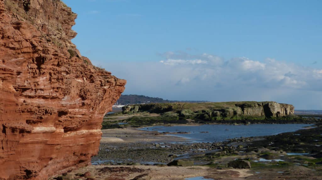
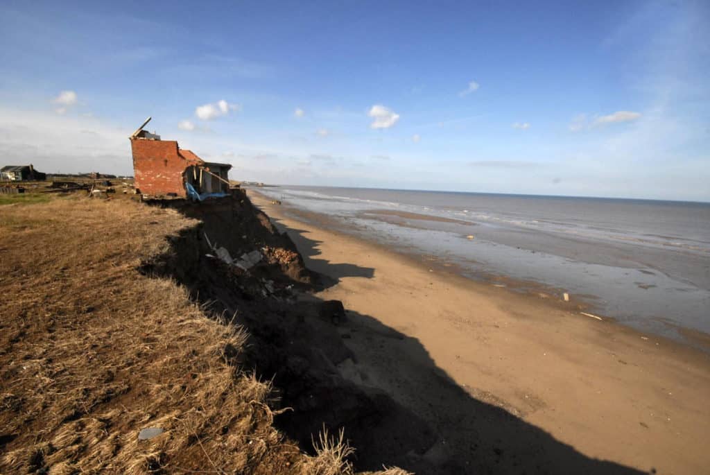
Different stretches of the coastline can be put into two different categories: high energy coasts and low energy coasts.
High energy coasts
- Waves are powerful (for a significant part of the year)
- The rate of erosion exceeds the rate of deposition
- Characteristic landforms include headlands, cliffs and wave-cut platforms
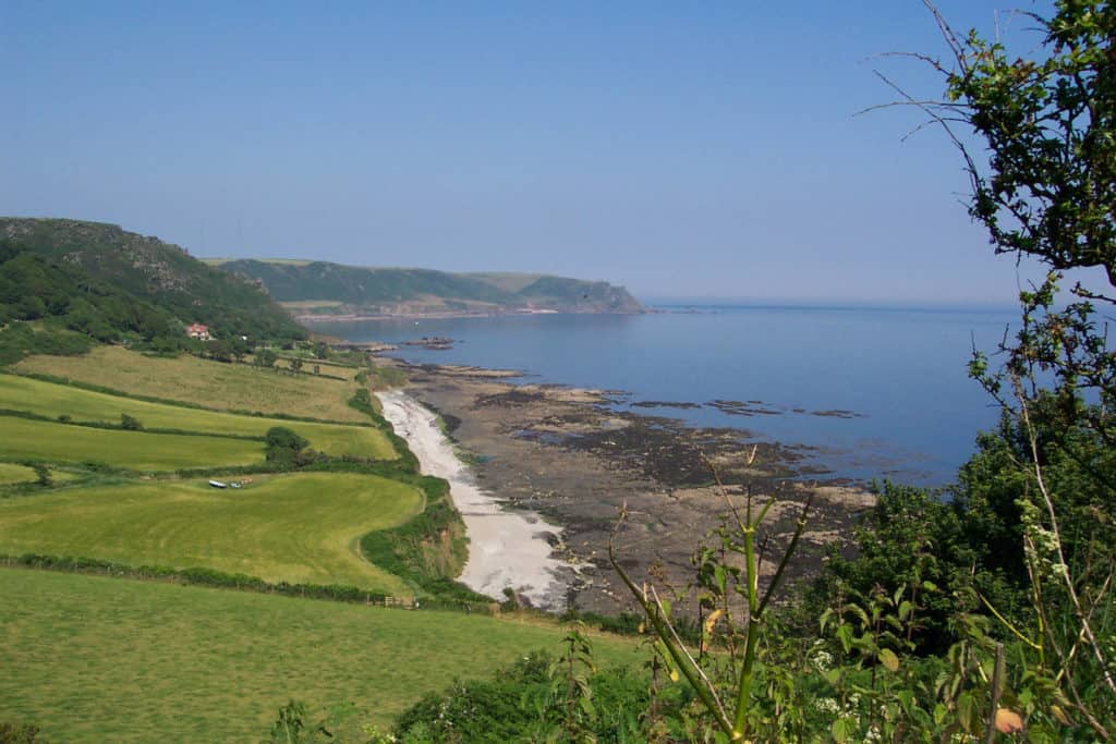
Low energy coasts
- Waves are not powerful (for a significant part of the year)
- The rate of deposition exceeds the rate of erosion
- Characteristic landforms include beaches and spits
What questions do geographers ask?
You can ask geographical questions about anywhere on the coast. Here are some examples.
- What coastal processes are happening here?
- What factors determine the shape of the cliffs and shore platform?
- How will this coastline change in the next 20 years?
- What coastal processes are happening here?
- Why is the shore platform neither smooth nor flat?
- How does wave action vary along this length of coast?
- What coastal processes are happening here?
- Is there a link between beach width and cliff height?
- What is the threshold event for cliff collapse?
Visit the BBC website to find photos of a rock arch and stack before and after the winter storms of 2013/4 http://www.bbc.co.uk/news/uk-25637142. What is the threshold event for this collapse? Could you investigate any other examples?
What questions could you investigate by fieldwork?
Here are some examples. Each research question has been split into 2 or 3 sub-questions.
| Research question | Sub questions |
|---|---|
| Why is there an uneven distribution of erosional landforms in the coastal landscape at x? | Where are erosional landforms (like cliffs, wave-cut platforms, headlands and bays, arches and stacks) found in the landscape at x? Is the rate of erosion linked to rock type (hard rock/soft rock) and structure (faults, joints and bedding planes)? Is the rate of erosion linked to wave power? |
| How and why do cliff profiles vary along the coast at x? | How does the height, gradient and shape of cliffs, shore platforms and wave-cut notches vary along the coast? To what extent is the cliff profile controlled by rock type and structure? Is there a link between cliff gradient and the width of the beach or wave-cut platform? |
| How and why does wave action vary between headlands and bays at x? | How does wave size, angle of approach and frequency vary between headlands and bays? Is there a link between wave action and the distribution of erosional and depositional landforms? |
Specialised geographical concepts
A good way to demonstrate challenge in your choice of research question and/or sub questions is to consider one or more of the specialised geographical concepts. Here are a few suggestions:
| Specialised concept | Research question or sub question> |
|---|---|
| Causality | To what extent do wave characteristics affect landforms at x? |
| Causality | What is the relationship between the rate of erosion and the resistance of the rocks? |
| Equilibrium | Is the beach at bay x an equilibrium form? |
| Feedback | Is there a negative feedback relationship between wave energy, cliffs and wave-cut platforms at x? |
| Risk | What factors put the cliffs at x at risk of rapid erosion? |
| Threshold | What is the threshold storm event for cliff failure at x? |
Choosing a fieldwork location
Find a 2-5km stretch of coast, with some variation in physical factors (such as rock type or aspect). Makes sure that there are several safe access points; this reduces the risk of being stranded by the rising tide. Alternatively you could investigate coastal processes in a smaller area (such as a single zeta-form beach in a bay) in more detail.
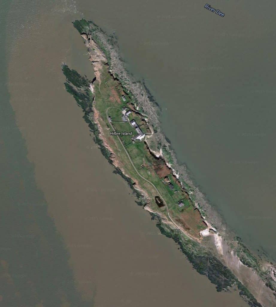
Hilbre Island (Cheshire) is an example of a possible fieldwork location. The length of perimeter approx 2km. It can be reached at low tide by walking from the mainland. Safe access points to the shoreline at several points around the edge. Is there a relationship between aspect and the rate of erosion? What other factors are important?

Secondary and Further Education Courses
Set your students up for success with our secondary school trips and courses. Offering excellent first hand experiences for your students, all linked to the curriculum.
Group Leader and Teacher Training
Centre-based and digital courses for teachers