Beach profiles allow you to identify changes in beach size and shape.
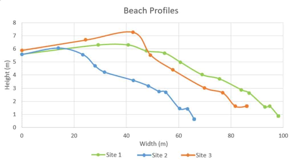
You could also calculate the cross-sectional area of the beach in order to quantify changes in overall beach size.
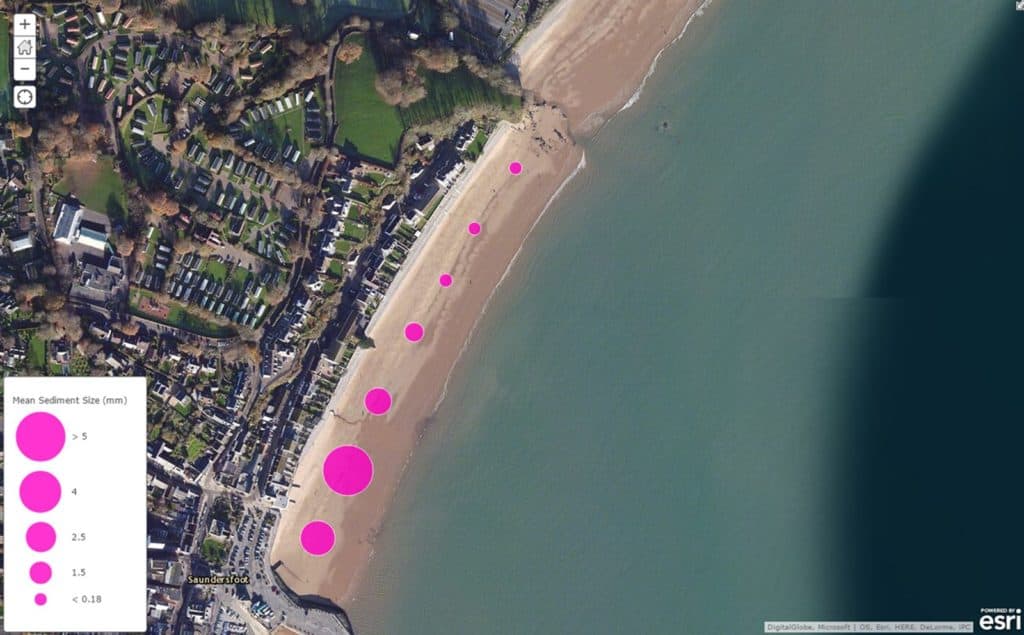
GIS can be a useful way of presenting your data. In this example, located proportional symbols are used to show changes in sediment size along the shore.

Secondary and Further Education Courses
Set your students up for success with our secondary school trips and courses. Offering excellent first hand experiences for your students, all linked to the curriculum.
Group Leader and Teacher Training
Centre-based and digital courses for teachers