Quantitative Methods
Sampling
For the collection of your quantitative data it is not necessary (or practical) to measure every part of a beach, or every pebble – you will need to take a sample.
A systematic sampling strategy, with sampling sites at equal intervals along a beach, will help remove bias in site selection, whilst ensuring that your data best illustrates any changes.
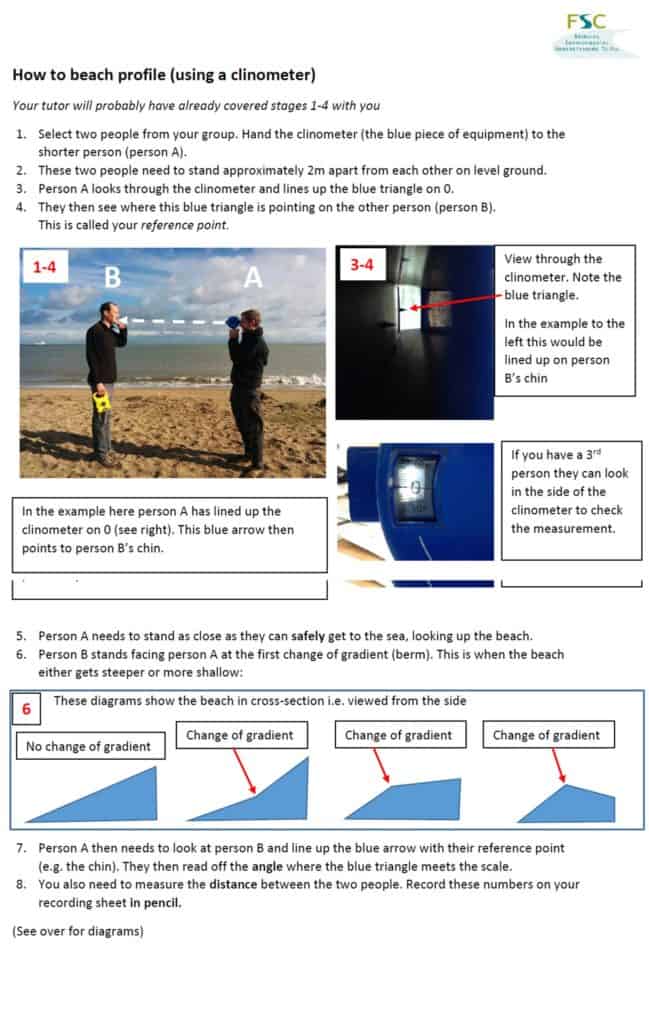
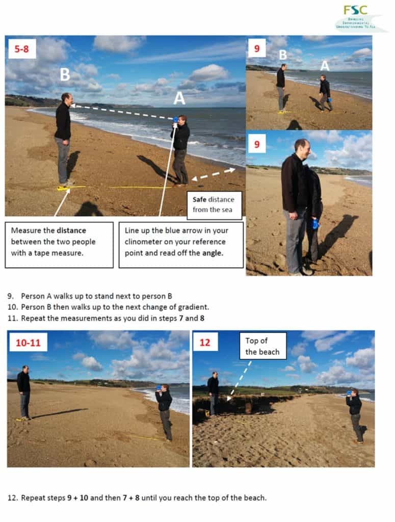
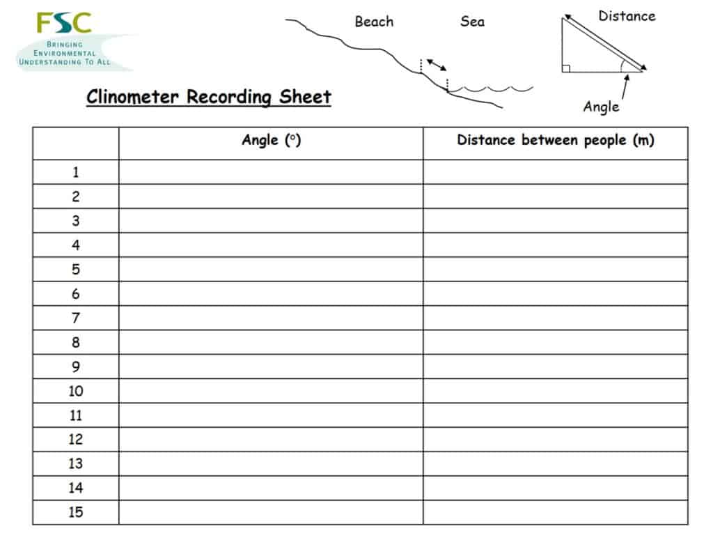
Measuring beach profiles
By measuring a series of beach profiles along the length of a beach we can consider changes in two dimensions:
- up the beach (moving away from the sea towards land)
- along the beach (parallel to the sea)
Measuring sediment size
Collect sediment samples from different sites up or along the beach.
10 pieces of sediment per location is the minimum number you should collect. Remember that the purpose of a sample is to get an idea of what all the sediment at that place is like. Out of all the pebbles at that bit of beach, 10 is still a very small sample!
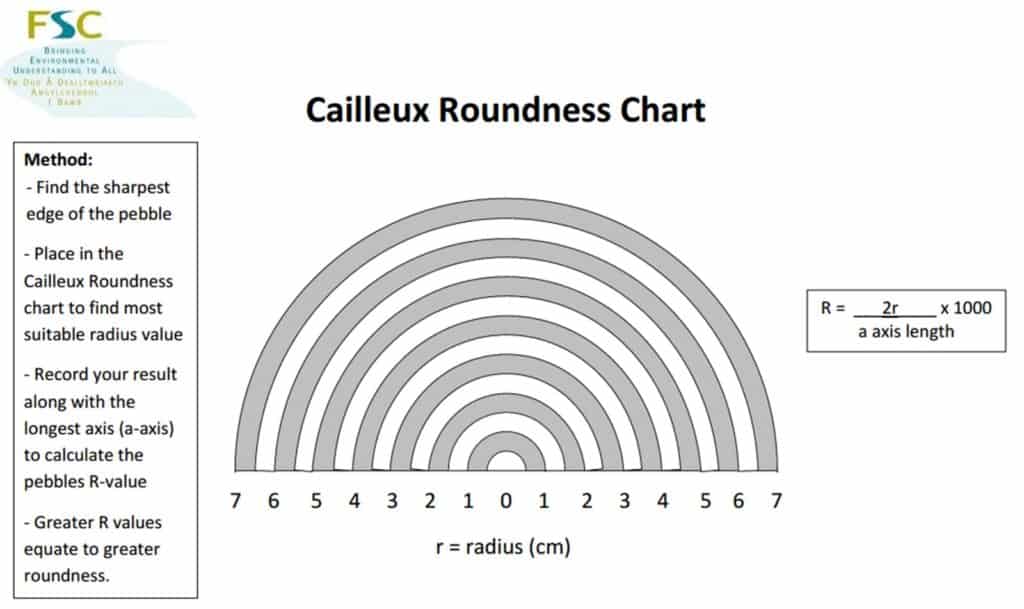
Use calipers or a ruler to measure the size of each pebble – you can measure the length of the longest side – The a-axis, or all three axes, a, b and c.
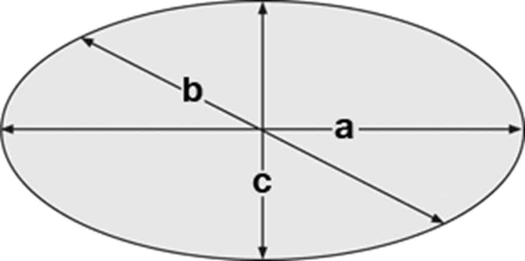
- a-axis = the longest side – the a-axis of a person is their height from head to toe
- b-axis = The second longest side – the b axis of a person is from shoulder to shoulder
- c-axis = The shortest side – The c-axis of a person is from front to back through their belly button
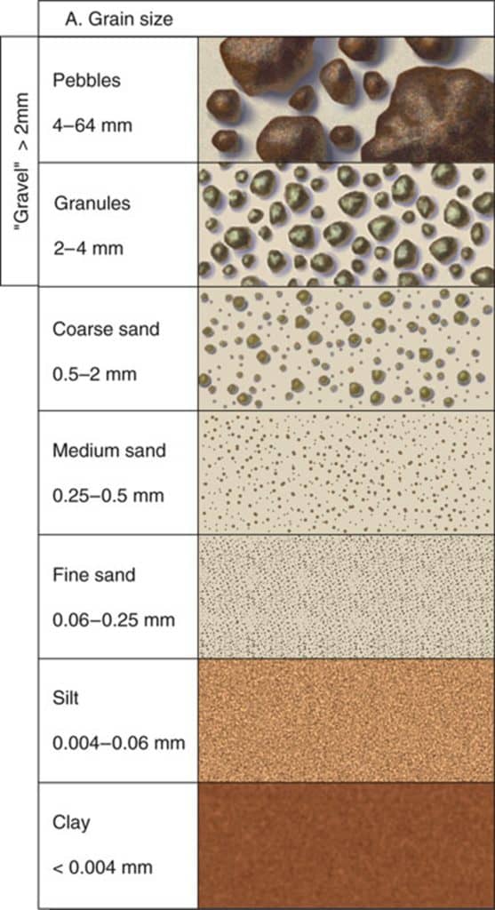
For very small sediment you will not be able to measure the size of individual pebbles – in this case you will need to use a grain chart size card.
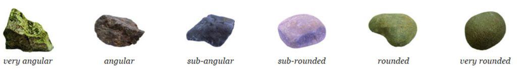
Measuring sediment roundness
For the same sediment sample, you can use either Power’s or Cailleux indices to assess the roundness of each pebble. Power’s index has the advantage of being quick and easy compared to Cailleux, however it is a more subjective scale.
Recording site location
The easiest way to accurately record the locations of your sampling sites is to use a GPS – there are many different Smartphone apps that will allow you to do this. If you want to use GIS to locate your sites on a map or to display your data, you need to record your location as latitude and longitude.
Qualitative methods
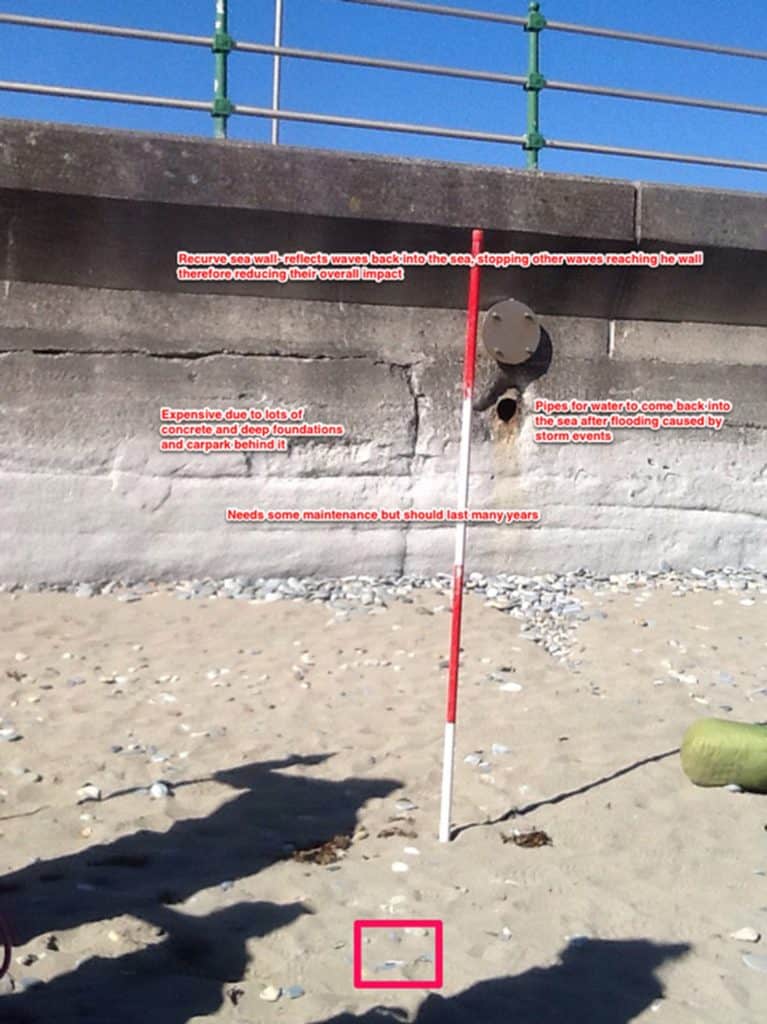
Coastal land forms can be recorded using annotated field sketches or annotated photographs. These can be used to look at a view of the whole landscape from a given point, or in detail at given features. Here are some suggested words.

Secondary and Further Education Courses
Set your students up for success with our secondary school trips and courses. Offering excellent first hand experiences for your students, all linked to the curriculum.
Group Leader and Teacher Training
Centre-based and digital courses for teachers