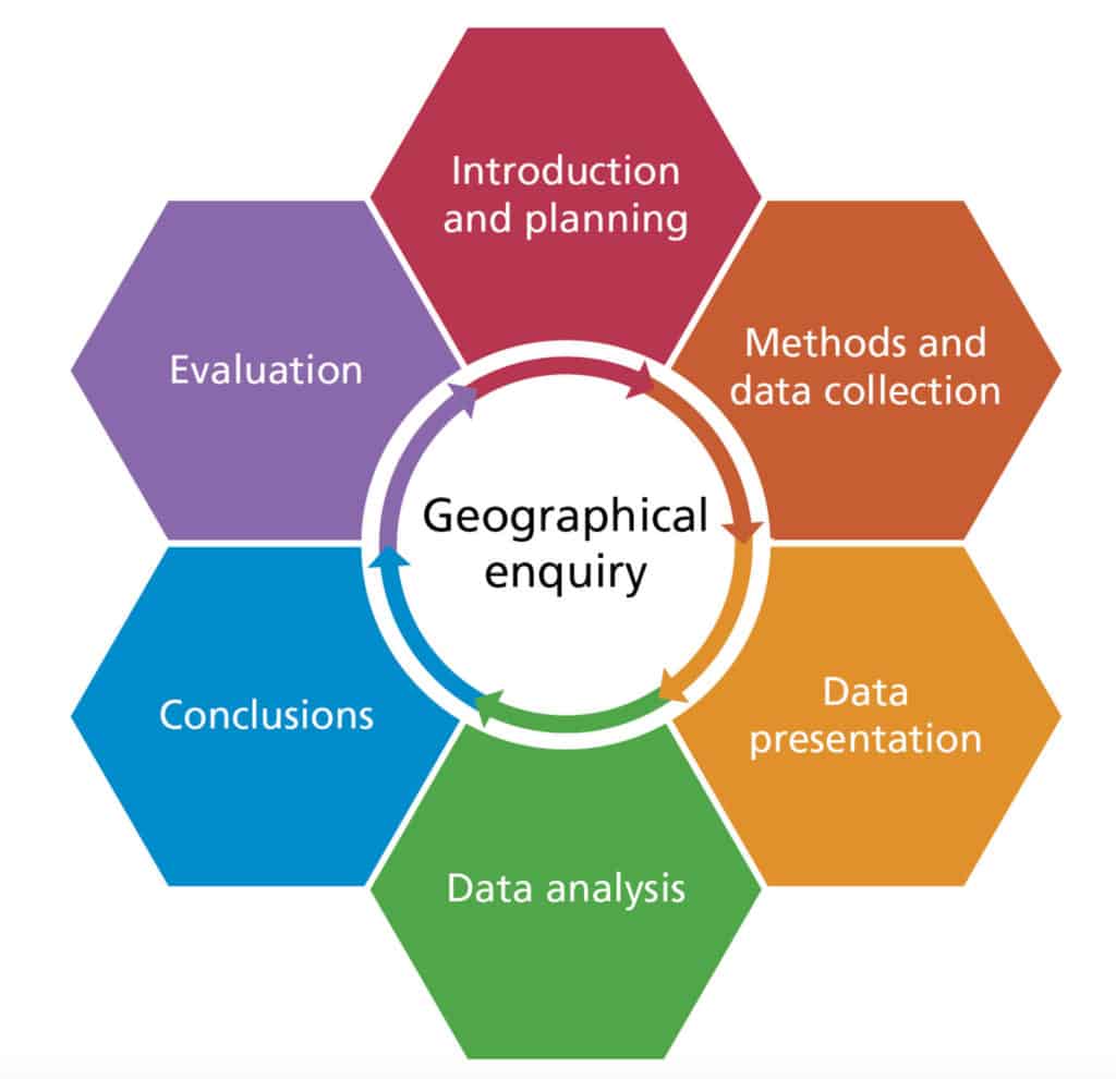
Fieldwork
Fieldwork is about finding out new things about people, places and environments.
To do this, geographers have to
- ask a geographical question
- collect useful information
- then use that information to try to answer the question
This can be split up into six stages
Asking geographical questions
Photographs, newspaper articles and secondary data can all be used to ask geographical questions. Here are some examples of general questions.
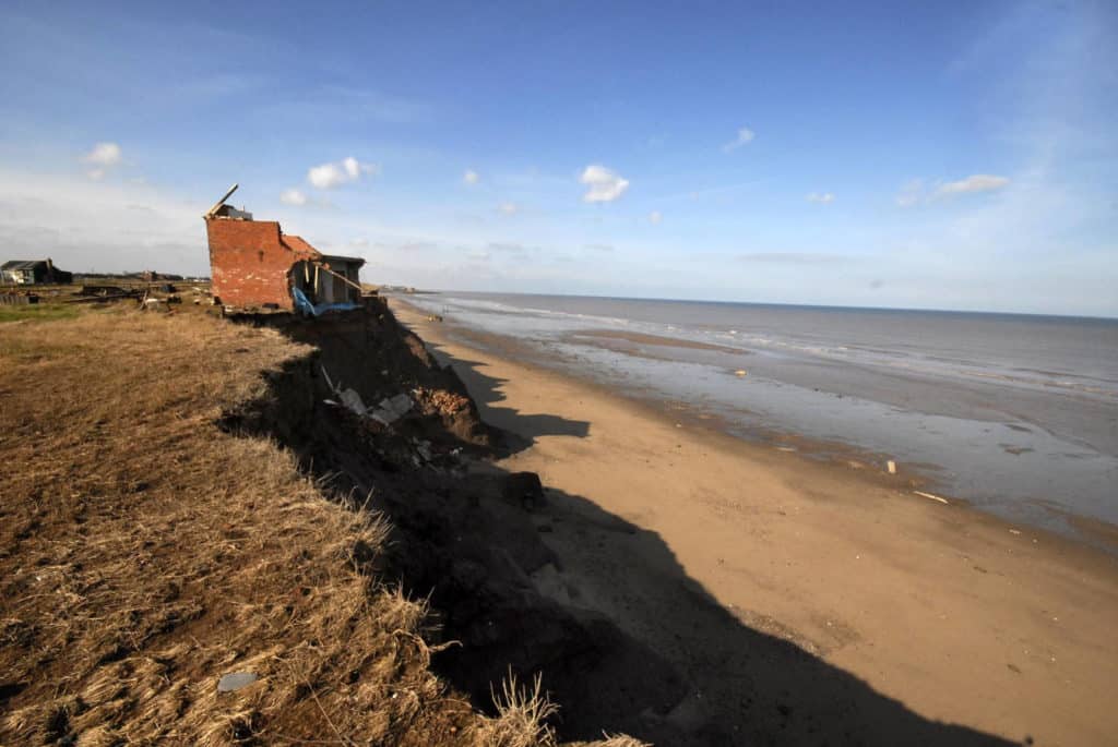
- What landforms can be identified here?
- Which processes are shaping this coastline?
- How might future climate change impact this landscape?
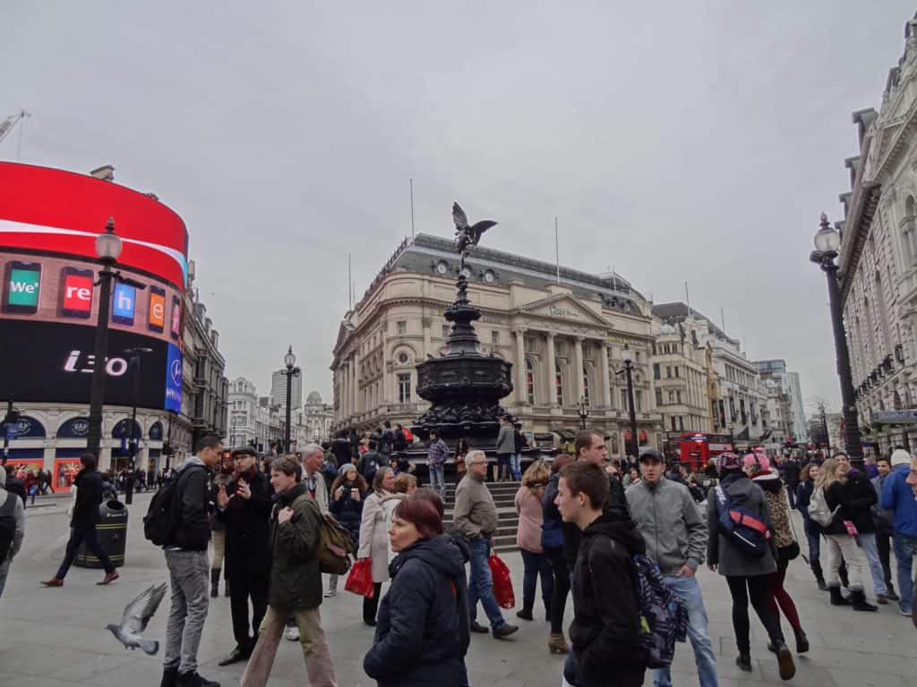
- What is happening here?
- How has this place changed in the last few years?
- How might this place change in the future?
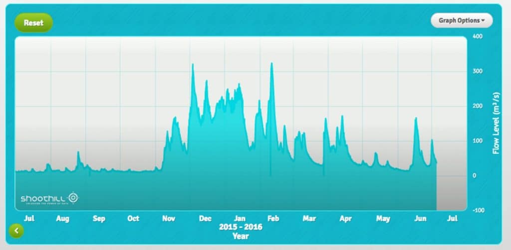
- How do river levels change during the year?
- Why do river levels change during the year?
- What are the effects of changing river levels on the people who live nearby?
Once you have decided on a general topic area, you can focus on the aims and hypotheses.
Aims and hypotheses
The aim is a general statement of what you are trying to find out.
One way of formulating an aim is to ask why two places are different, or why the same place has changed over time, e.g.
- An investigation into how and why there is a difference in functions between the villages of Minsterley and Pontesbury
- An investigation into beach characteristics on the north-facing and south-facing sides of Dawlish Warren
- An investigation into how and why retailing has changed in the centre of Carlisle since 2000
Another way of formulating an aim is to ask how and why things are linked, e.g.
- An investigation into changes in beach profile changes along Weymouth Beach
- An investigation into changes in river channel characteristics with distance downstream at Woodley Beck
- An investigation into changes in retail characteristics with distance from the peak land-value intersection in Barnsley
The hypothesis is a statement that you can test. It needs to be clear, directional and measurable, e.g.
- River velocity increases as distance increases from the source of Woodley Beck
- Beach profile is steeper on the south-facing than the north-facing side of Dawlish Warren
- Environmental quality declines with distance from the PLVI in Barnsley
A null hypothesis is a special form of hypothesis.
The null hypothesis and alternative hypothesis can be constructed from the research hypothesis.
| Research hypothesis | River velocity increases as distance increases from the source of Woodley Beck |
| Null hypothesis | There is no relationship between river velocity and distance downstream at Woodley Beck |
| Alternative hypothesis | There is a significant relationship between river velocity and distance downstream at Woodley Beck |
When you carry out a geographical investigation, you must assume that the null hypothesis is true, and only change your mind (and reject the null hypothesis) if there is strong enough evidence to show otherwise.

Secondary and Further Education Courses
Set your students up for success with our secondary school trips and courses. Offering excellent first hand experiences for your students, all linked to the curriculum.
Group Leader and Teacher Training
Centre-based and digital courses for teachers