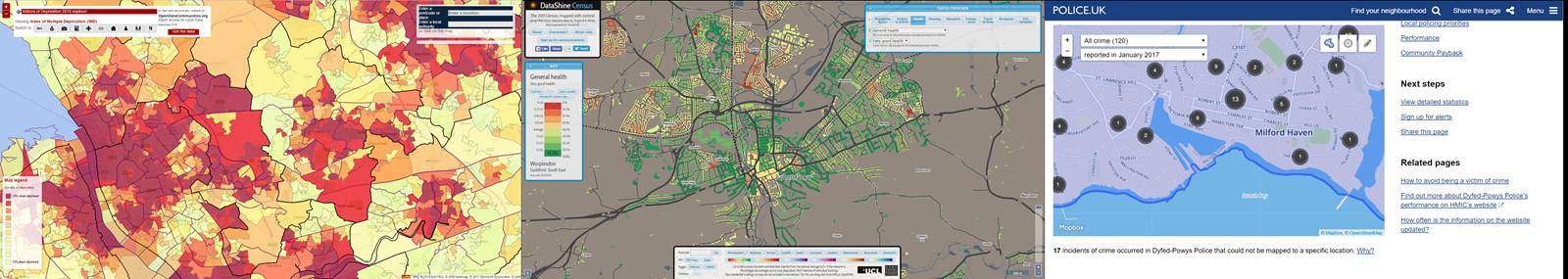
Geographical Information Systems are a great source of secondary data to help find topics and places to investigate. No matter what your starting point, GIS can help you to choose a location, ask enquiry questions, and carry out contextualising research.
Using GIS to help you develop a question
There are several positions from which you might be starting out – whichever situation you are in you might find using maps and GIS data helps you identify and refine your question.
- Your teacher has given you a fieldwork destination, or you are looking to complete your fieldwork locally
- You know the general area you are visiting (e.g. Guildford). But you have not chosen the area(s) your question will focus on (e.g. North Street Market in Guildford)
- You need to identify a theme that your question will focus on
It is time to do some contextualising research relating to your chosen theme and location.
The aim of contextualising research is to make sure you know enough about the location to generate sensible questions or hypotheses.
This contextualising research can help you avoid questions that will probably not work, like one of the examples below:
- Asking a question about the success of regeneration in an area where no regeneration has taken place
- Trying to assess the impact of a flood in a settlement with no history of flood events
- Hypothesising that different soil types will affect infiltration rates in a catchment if only one soil type is present
All these sound like daft questions, but only when set in the context of some background knowledge.
Good questions or hypotheses will be based on geographical theory AND some relevant understanding of the location.
GIS for Data Collection
GIS can help you plan where and how you collect data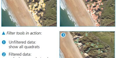
GIS for Data Presentation
GIS can quickly draw a range of maps from your data, making it easy to pick the most appropriate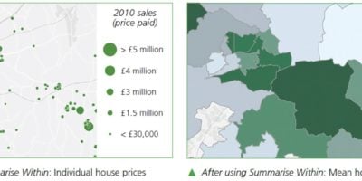
GIS for Data Analysis
GIS offers a range of tools to summarise raw data, carry out calculations and find spheres of influence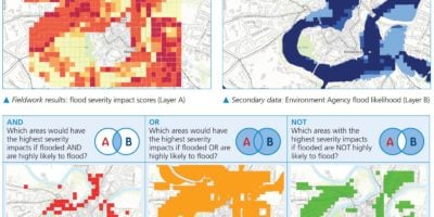
GIS for Drawing Conclusions
GIS makes it much easier to look for links between different sets of results
GIS for Evaluations
Use GIS to critically examine the accuracy, validity and reliability of your findings
GIS Support
Teach with GIS is a resource aimed at supporting schools, students and educators with getting to grips with ArcGIS.
Secondary and Further Education Courses
Set your students up for success with our secondary school trips and courses. Offering excellent first hand experiences for your students, all linked to the curriculum.
Group Leader and Teacher Training
Centre-based and digital courses for teachers